Catalog Archive
Auction 184, Lot 89

"Map of the New Continent Exhibiting Its Greatest Diametral Length from the River Plata to the Lake Assiniboils", Bell, Andrew

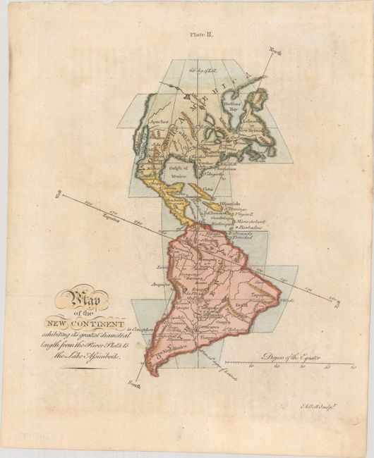
Subject: Western Hemisphere - America

Period: 1770 (circa)

Publication: Encyclopaedia Britannica

Color: Hand Color

Size:
7.3 x 8.1 inches
18.5 x 20.6 cm
Download High Resolution Image
(or just click on image to launch the Zoom viewer)

This striking miniature map is derived from Gibson's similarly titled map that appeared in the Gentleman's Magazine in December 1758. The cartography remains the same, but Bell's map lacks the decorative title cartouche. It presents a very interesting, if somewhat peculiar projection, with north oriented to the top right. A long Northwest Passage, consisting of a system of rivers and lakes, reaches across from the Great Lakes towards the Pacific. The northwestern part of North America is otherwise left blank.

References:

Condition: B+

Issued folding, now flat, with light toning.

Estimate: $110 - $140

Sold for: $80

Closed on 9/15/2021

Archived