Catalog Archive
Auction 184, Lot 810

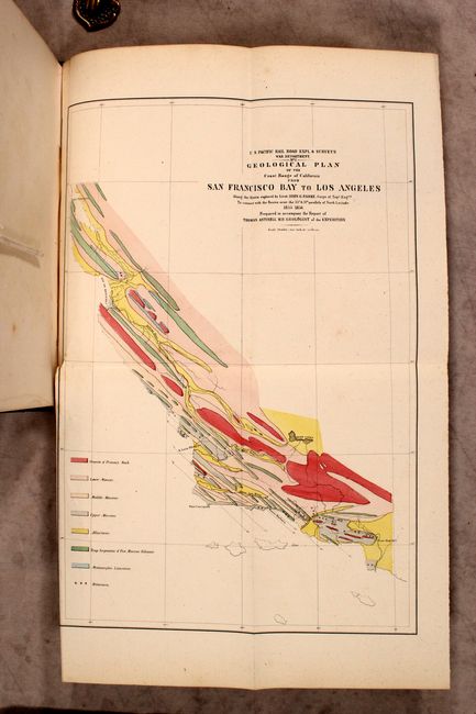
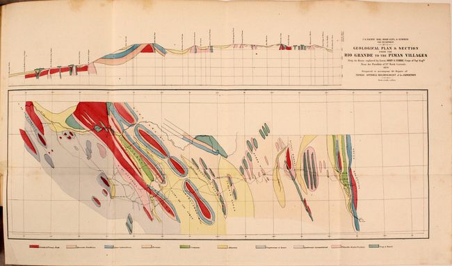
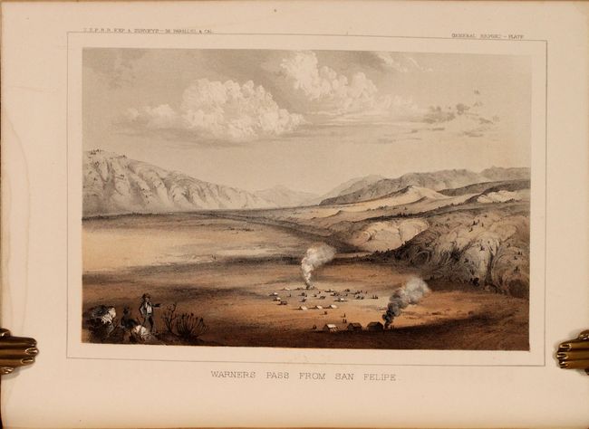
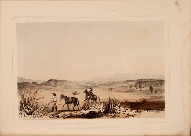
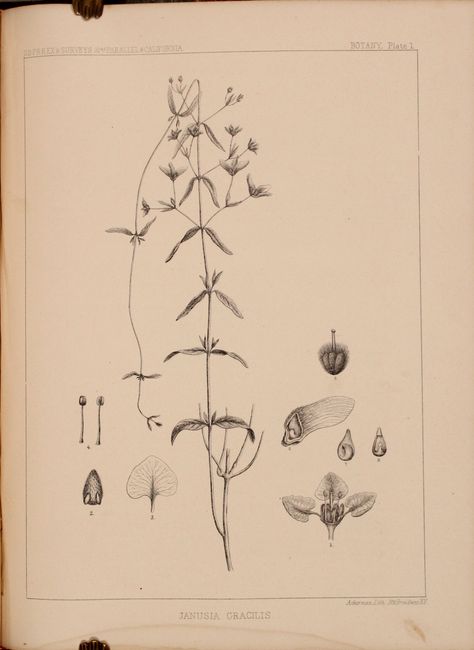
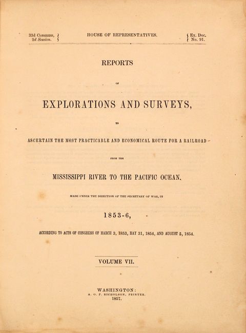
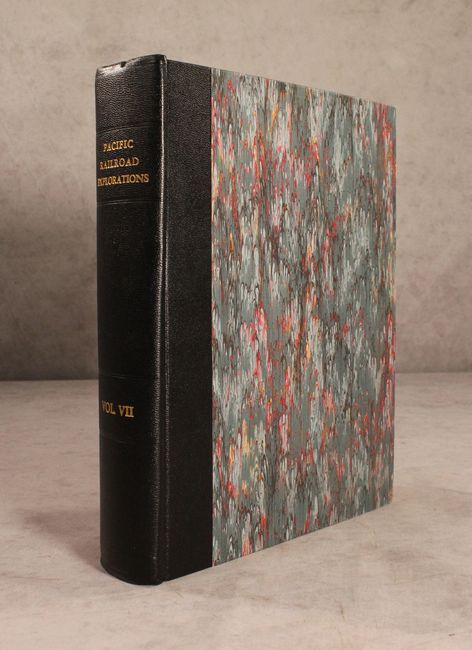
"Reports of Explorations and Surveys, to Ascertain the Most Practicable and Economical Route for a Railroad from the Mississippi River to the Pacific Ocean ... Volume VII", U.S. Railroad Surveys

Subject: Exploration & Surveys, Pacific Railroads

Period: 1857 (published)

Publication: H.R. Doc. 91, 33rd Congress, 2nd Session

Color: Hand Color

Size:
9.2 x 11.9 inches
23.4 x 30.2 cm
Download High Resolution Image
(or just click on image to launch the Zoom viewer)

During the 1850s, the U.S. government sponsored an extensive series of expeditions designed to gather information on the vast new territories that had been acquired in western North America. The discovery of gold in California further stimulated westward traffic and heightened the need for a faster and more convenient way to bring the far-flung parts of the country together. In 1853 Congress commissioned the Army's Topographic Bureau to conduct a series of surveys to find a suitable route for a transcontinental railroad. There were six major expeditions; five of them covered the area between the Great Plains and west coast, and the sixth explored the coastal states of California and Oregon. All of these expeditions were accompanied by naturalists and artists to document the landscape, flora and fauna along the route. The reports, maps and lithographs were published in the 13 volume report "Explorations and Surveys to ascertain the most practicable and economical route for a Railroad from the Mississippi river to the Pacific Ocean."

This is volume VII of the monumental surveys used for the planning and design of a railroad between the Mississippi River and the Pacific Ocean. These surveys were instrumental in documenting the unique natural history, biology, geology and ethnology, in addition to the geography of the western U.S. The report contains 8 color lithographic views, 43 paleontology, botany and geology plates, and a pair of maps. The first map, Geological Plan of the Coast Range of California from San Francisco Bay to Los Angeles (11 x 16.75"), is a colorful geological map employing delicate hand coloring to reflect geological knowledge. The eight geological types are color-coded per the legend at left according to the surveys of the U.S. Pacific Railroad exploration. The map contains interesting details regarding watersheds throughout, especially near the Bay of Monterey. The Kern Lakes are depicted. In Southern California, Los Angeles, Santa Barbara, San Luis Obispo, and more cities are located. Prepared to accompany the report of Thomas Antisell, M.D., Geologist of the Expedition. The other map, Geological Plan and Section from the Rio Grande to the Pimas Villages (23 x 8.25"), also uses attractive hand color to delineate 10 different geological types found along a stretch of land from El Paso to Maricopa Wells. The tracks of Lt. John G. Parke, of the Topographical Engineers are shown, as is the location of the beautiful Mission San Xavier del Bac near Tucson. The map is also shown as a profile in the upper margin. 399 pages. Quarto, rebound in quarter faux black leather over marbled boards with gilt title on the spine.

References:

Condition: B+

The maps are very good with short binding tears that have been closed with archival tape (the repair to the second map was on recto). Plates are mostly clean and bright with occasional foxing and more frequent dampstains confined to the bottom blank margin. Text is mostly clean with occasional toned pages and scattered foxing. Modern binding is pristine.

Estimate: $400 - $475

Sold for: $300

Closed on 9/15/2021

Archived