Catalog Archive
Auction 184, Lot 167

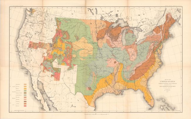
"Map of the United States Exhibiting the Present Status of Knowledge Relating to the Areal Distribution of Geologic Groups (Preliminary Compilation)", U.S. Geological Survey (USGS)

Subject: United States, Geology

Period: 1884 (dated)

Publication: Fifth Annual Report of the United States Geological Survey…

Color: Printed Color

Size:
28.2 x 17.4 inches
71.6 x 44.2 cm
Download High Resolution Image
(or just click on image to launch the Zoom viewer)

This is the first published geological map of the United States by the USGS. It is generally referred to as the McGee map after the compiler. The legend at lower left names and color codes eleven different geological groups. There is also very fine detail of hydrology. Vast areas of the western U.S. remain blank, reflecting the infancy and inadequacy of western geological explorations at the time, and coincidentally emphasizing the need for more congressional funding. The mapping of the King, Hayden, Powell and Wheeler surveys are evident in the West, but little else. This was the most up-to-date map at the time, but was soon superseded by Hitchcock's 1886 map that augmented the western states' geological detail.

References:

Condition: B+

Issued folding with some minor toning along a few folds and a short fold separation at top left that has been closed on verso with archival tape.

Estimate: $140 - $170

Sold for: $80

Closed on 9/15/2021

Archived