Catalog Archive
Auction 184, Lot 145

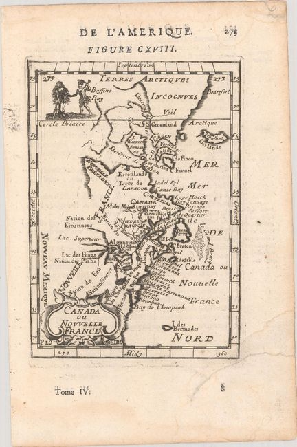
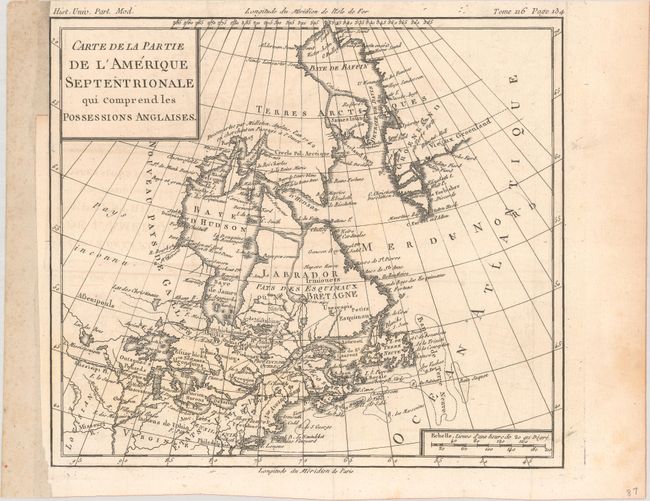
"[Lot of 2] Canada ou Nouvelle France [and] Carte de la Partie de l'Amerique Septentrionale qui Comprend les Possessions Anglaises",

Subject: Colonial Northeastern United States & Canada

Period: 1683-1782 (circa)

Publication:

Color: Black & White

Size:
See Description
Download High Resolution Image
(or just click on image to launch the Zoom viewer)

A. Canada ou Nouvelle France, by Alain Manesson Mallet, from Description de l'Univers, circa 1683 (3.9 x 5.6"). This charming small map depicts the eastern seaboard from Chesapeake Bay to Greenland. The Great Lakes are shown open-ended in the west allowing the possibility of a Northwest Passage. The map extends to include Bermuda. It names Lake Superior, the Cercle Polaire, and shows Nouveu Mexique at extreme lower left. The map is decorated with a strapwork title cartouche at lower left and a vignette at upper left that shows two Indians and an infant. Page number 275 at upper right and French text on verso. References: Kershaw #267; McCorkle #683.3; Pastoureau, MANESSON-MALLET I A [626]. Condition: A dark impression on a sheet with a bunch of grapes watermark, two archivally repaired tears at bottom right, and several damps stains along the edges of the sheet, entering the map border at bottom right. (A)

B. Carte de la Partie de l'Amerique Septentrionale qui Comprend les Possessions Anglaises, by Louis Brion de la Tour, from Histoire Universelle, circa 1782 (10.0 x 8.8"). This uncommon map shows the colonial possessions as well as the new United States. The map stretches from Greenland and Baffin Bay to Philadelphia, and extends west past Lake Superior to the Pays Inconnu (unknown country) and the Louisiana Territory. Condition: Issued folding on watermarked paper with a hint of offsetting. A binding trim at left has been replaced with old paper. (B+)

References:

Condition:

See description above.

Estimate: $240 - $300

Sold for: $135

Closed on 9/15/2021

Archived