Catalog Archive
Auction 183, Lot 95

"Nova Tabula Geographica Complectens Borealiorem Americae Partem; in qua Exacte Delineatae sunt Canada sive Nova Francia, Nova Scotia, Nova Anglia, Novum Belgium, Pensylvania, Virginia...", Visscher, Nicolas

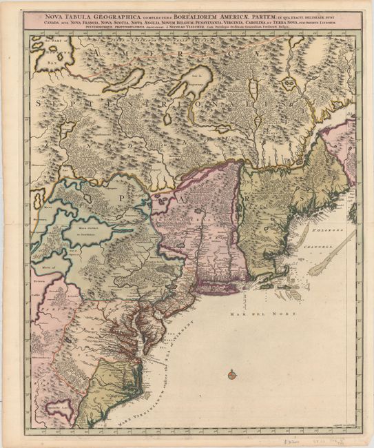
Subject: Colonial Northeastern United States & Canada

Period: 1696 (circa)

Publication: Atlas Minor

Color: Hand Color

Size:
18.5 x 23.3 inches
47 x 59.2 cm
Download High Resolution Image
(or just click on image to launch the Zoom viewer)

Great map of the northeast coast of North America, from the Carolinas to Quebec and inland to the Great Lakes. It depicts all of Lake Ontario and parts of Lakes Huron and Erie. The map is based on the western part of the Coronelli/Nolin map of 1689 and shows the divisions between the French and British colonies. It is beautifully engraved with topographical features. Colonial settlement is confined to the seaboard and rivers. In the interior a number of Indian nations are shown. This is the second state. Engraved by Luggert van Anse.

References: Burden #731; McCorkle #689.8.

Condition: A

Full contemporary color with minor toning along the edges of the sheet.

Estimate: $1,600 - $1,900

Sold for: $1,075

Closed on 6/9/2021

Archived