Catalog Archive
Auction 183, Lot 200

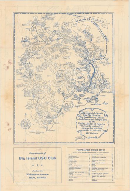
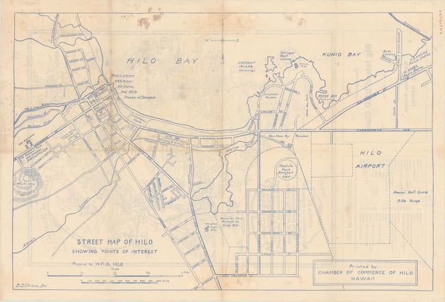
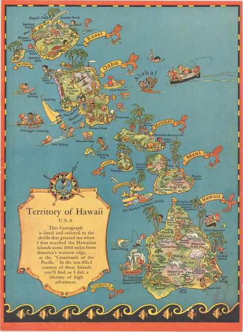
"[Lot of 2] Island of Hawaii [and] Territory of Hawaii U.S.A...", White, Ruth Taylor

Subject: Hawaii

Period: 1940-44 (circa)

Publication:

Color: Printed Color

Size:
See Description
Download High Resolution Image
(or just click on image to launch the Zoom viewer)

A. Island of Hawaii, circa 1944 (11.3 x 14.6"). Ruth Taylor White's charming pictorial maps are among the most popular collectible maps of the early 20th century. These whimsical maps, often known as cartographs, combine graphic style, color and comical observation and are drawn in a whimsical, humorous style much like Jo Mora's celebrated work of the same period. In this map of the "Big Island," cartoonish characters populate the island with major roads and points of interest noted, which actually makes this a fairly useful map for the tourist. Decorated by a ribbon style banner and a descriptive cartouche. This version of the map is printed in blue ink with "compliments of Big Island USO Club." The verso contains a full-page Street Map of Hilo Showing Points of Interest (19.9 x 13.2") by B.D. Chilson. Only example located was at the Library of Congress. Condition: Issued folding with some light staining mostly in the blank margins.

B. Territory of Hawaii U.S.A..., circa 1940 (8.0 x 10.8"). This pictorial map covers the entire Hawaiian archipelago with tiny illustrations representative of each island. Below the title at lower left, White notes that "in the sun-filled corners of these Islands you'll find, as I did, a lifetime of high adventure." Related text on verso including 27 Hawaiian words with English translations. Condition: Light staining at lower right.

References:

Condition: B+

See description above.

Estimate: $160 - $190

Sold for: $85

Closed on 6/9/2021

Archived