Catalog Archive
Auction 183, Lot 18

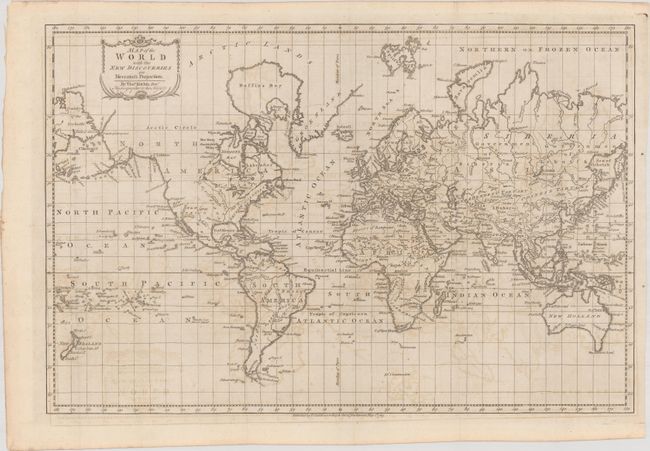
"Map of the World with the New Discoveries on Mercator's Projection", Kitchin, Thomas

Subject: World

Period: 1783 (dated)

Publication:

Color: Black & White

Size:
20.3 x 13.4 inches
51.6 x 34 cm
Download High Resolution Image
(or just click on image to launch the Zoom viewer)

This map presents an interesting view of the world in 1783 with emphasis on British interests and discoveries. The Eastern U.S. is still labeled British Colonies. The remainder of North America lacks boundaries, although the areas of New Albion, New Mexico, Louisiana, and Canada are named. San Francisco Bay is named Port Sir Francis Drake. The islands of the Pacific Ocean receive special attention, highlighting the discoveries of Capt. Cook, with O-Why-Hee featured within the Sandwich Islands. Australia (New Holland) is almost fully delineated, except Tasmania (Van Diemens Land) is shown attached to the mainland. Asiatic Russia is made up of the Government of Siberia and the Government of Irkutsk. Cook’s Str. separates Asia and North America. The map was published by Thomas Cadell.

References:

Condition: B+

Issued folding with light offsetting.

Estimate: $275 - $350

Sold for: $350

Closed on 6/9/2021

Archived