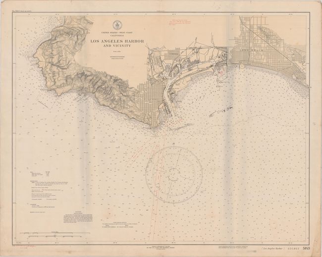
"United States - West Coast California Los Angeles Harbor and Vicinity", U.S. Coast & Geodetic Survey
Subject: Los Angeles, California
Period: 1932 (dated)
Publication:
Color: Printed Color
Size:
31 x 24.3 inches
78.7 x 61.7 cm
This detailed chart extends from Malaga Cove east to Alamitos Bay and shows the street grid pattern of San Pedro and Long Beach and the rugged topography of the coastline. Includes excellent detail of the harbor area locating docks, channels, storage tanks, railroads, and more. The surrounding waters are filled with soundings, bottom types, "cable areas," and large compass with magnetic variation. Stamp on verso indicates it was "corrected through Oct 22 32." There are no previous sales records and OCLC shows only two locations (Stanford and Huntington).
References:
Condition: B
There is light soiling, a few minor manuscript notations, and creases at left and right where a previous owner folded the map. Pinholes and a few edge tears are confined to the blank margins.