Catalog Archive
Auction 183, Lot 133

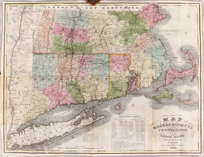
"Map of Massachusetts Connecticut and Rhode Island Constructed from the Latest Authorities", Sumner, H. F.

Subject: New England - United States

Period: 1833 (dated)

Publication:

Color: Hand Color

Size:
19.7 x 15.1 inches
50 x 38.4 cm
Download High Resolution Image
(or just click on image to launch the Zoom viewer)

This scarce map appears to be a slightly reduced version of Anthony Finley's 1826 atlas map with the same title. It depicts counties, roads, proposed and existing railroads & canals, and locates scores of towns and villages. At bottom is a "Statistical Table" giving populations by county for 1820 and 1830, and the inside cover has a paper label that lists population of principal towns. Folds into brown leather boards with gilt title on the front cover (3.4 x 5.2").

References:

Condition: B+

Contemporary color on a clean sheet with two small repairs along the fold lines at top right. Covers have light wear.

Estimate: $300 - $375

Unsold

Closed on 6/9/2021

Archived