Catalog Archive
Auction 182, Lot 806

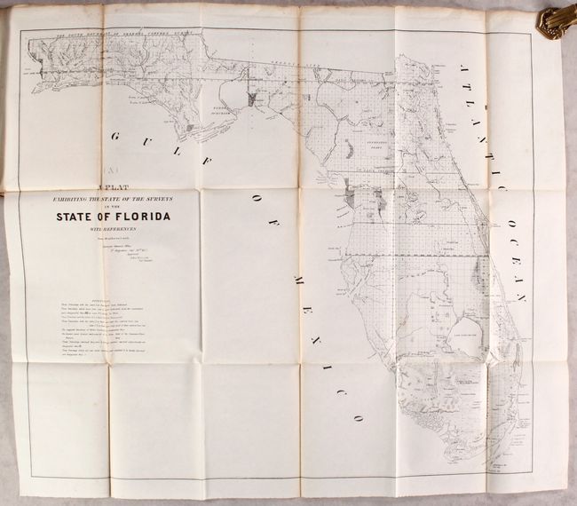
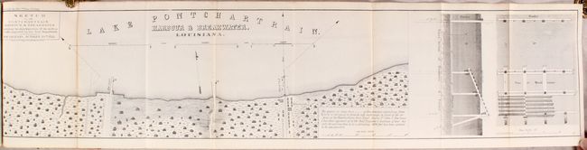
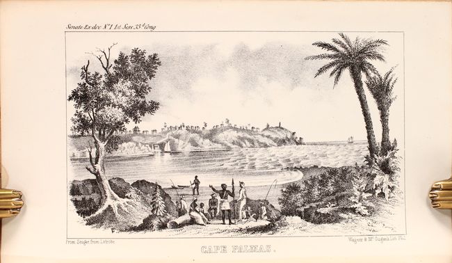
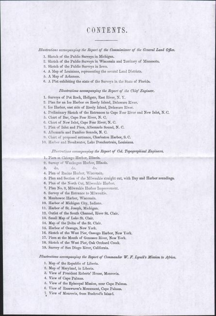
"[Maps and Views] Message from the President of the United States … First Session of the Thirty-third Congress. Part IV. Maps and Other Illustrations Belonging to Reports Accompanying the Message", U.S. Government

Subject: Exploration & Surveys

Period: 1853 (published)

Publication: Sen. Ex. Doc. 1, 33rd Congress, 1st Session

Color: Black & White

Size:
6 x 9.2 inches
15.2 x 23.4 cm
Download High Resolution Image
(or just click on image to launch the Zoom viewer)

This is the complete volume of illustrations accompanying the reports submitted for the 1st session of the 33rd Congress. The volume contains 37 folding maps and 5 single-page plates including 6 General Land Office maps (Michigan, Wisconsin and Minnesota, Iowa, Louisiana, Arkansas, Florida). There are also many harbor and river maps, including Survey of San Diego River and Harbor and Breakwater, Lake Pontchartrain, Louisiana, two large maps of Liberia, and five illustrations of Liberian sites. This example was published without the “Contents” page listing the maps, supplied here in facsimile (see images). Hardbound in contemporary leather with gilt title labels on spine.

References:

Condition: B+

Maps are mostly clean and bright with only occasional minor foxing or light toning along the folds. Covers have light wear and are cracking at the hinges.

Estimate: $180 - $220

Sold for: $100

Closed on 4/28/2021

Archived