Catalog Archive
Auction 182, Lot 800

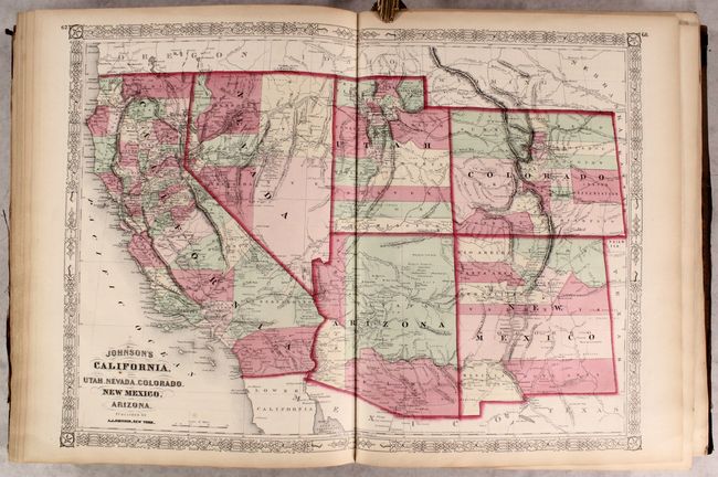
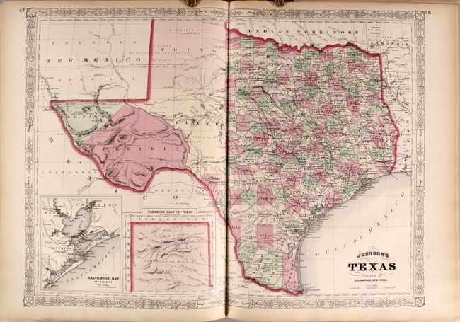
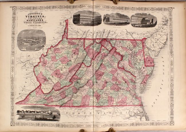
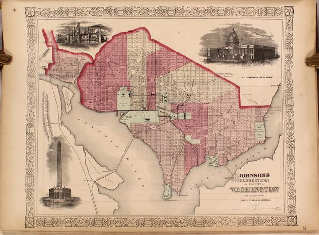
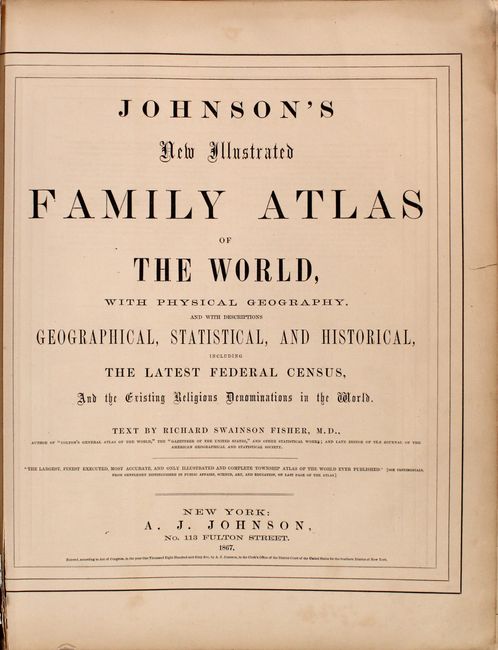
"Johnson's New Illustrated Family Atlas of the World, with Physical Geography, and with Descriptions Geographical, Statistical, and Historical...", Johnson, A. J.

Subject: Atlases

Period: 1867 (published)

Publication:

Color: Hand Color

Size:
14.9 x 18.8 inches
37.8 x 47.8 cm
Download High Resolution Image
(or just click on image to launch the Zoom viewer)

This atlas contains 41 (out of 58) beautifully rendered maps, consisting of 27 double-page and 14 single-page maps. There are several thematic maps and diagrams interspersed throughout the text that display the geology, weather, tides, agriculture, flags and animal kingdoms of the world. The steel-engraved frontispiece is a lovely view of the US Capitol.

This edition includes the Southwest map depicting the original four counties of Yavapai, Mohave, Yuma, and Pima in the newly organized Arizona Territory, with Prescott as the capital. The Utah/Nevada border is now at 114° and Arizona and Nevada have their final borders. Early historical details include the Pony Express and United States Mail routes, the emigrant roads to California, and the proposed southern railroad route.

The double-page map of Texas shows county development mostly in eastern Texas and only the four large counties of Young, El Paso, Presidio and Bexar in the west. The panhandle, noted as the Staked Plain … without Wood or Water, includes a large section that is unorganized. There is nice depiction of the wagon roads, many named, with several completed railroads. The inset maps are 'Northern part of Texas' and 'Plan of Galveston Bay.'

Folio. 137 pp., frontispiece, 41 maps, and charts depicting mountains and rivers of the world, thematic maps, flags, and coats of arms. This example is missing the maps of North America, Canada, United States, New York City, Vicinity of Richmond, Florida, Mississippi/Arkansas/Louisiana, Kentucky/Tennessee, Missouri/Kansas, Nebraska/Dakota/Idaho/Montana, Oregon/Washington, Minnesota, West Indies, Ireland/Scotland, France, Russia, and Africa. Hardbound in original quarter leather with tips and brown cloth, embossed covers with gilt titles on cover and spine.

References:

Condition: B+

Condition code is for the maps, which are in very good condition with light toning and occasional foxing or soiling. A handful of maps are disbound, and a couple of maps have minor tears along the edges of the sheet. There is a dampstain along the top edge that is confined to the blank margins on nearly all of the engravings. The covers are heavily worn and stained; the front cover is completely detached and the back cover is partially detached with a portion of the leather missing.

Estimate: $600 - $750

Sold for: $400

Closed on 4/28/2021

Archived