Catalog Archive
Auction 182, Lot 404

NO RESERVE

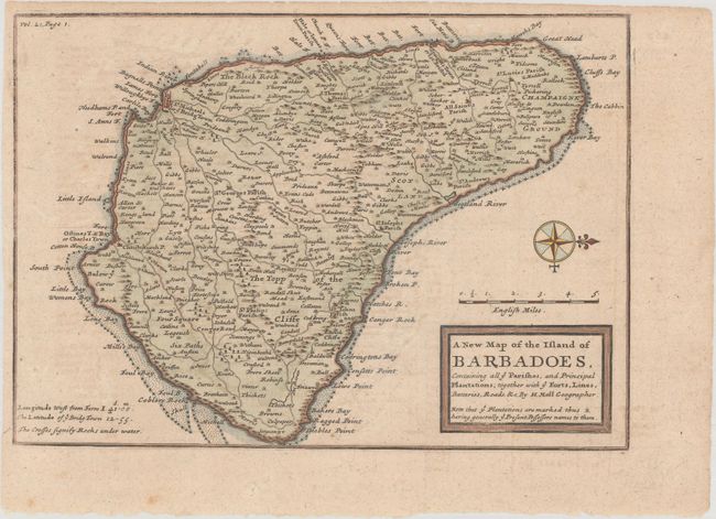
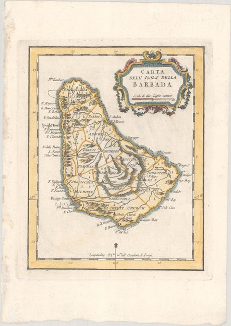
"[Lot of 2] A New Map of the Island of Barbadoes, Containing All ye Parishes, and Principal Plantations... [and] Carta dell' Isola della Barbada",

Subject: Barbados

Period: 1717-81 (circa)

Publication:

Color: Hand Color

Size:
See Description
Download High Resolution Image
(or just click on image to launch the Zoom viewer)

A. A New Map of the Island of Barbadoes, Containing All ye Parishes, and Principal Plantations; Together with ye Forts, Lines, Batteries, Roads, &c., by Herman Moll, from Atlas Geographus..., circa 1717 (10.1 x 7.1"). This small, copper-engraved map shows the island fully engraved and filled with towns and villages, roads, mills, plantations, political divisions, and many coastal details. A compass rose orients north to the right. Condition: Issued folding with light toning and soiling. (B+)

B. Carta dell' Isola della Barbada, by Jacques Nicolas Bellin, from Teatro della Guerra Maritima..., circa 1781 (6.1 x 7.6"). This is Bellin's small map of Barbados, completely re-engraved and with the addition of Italian place names. The map divides the island into eleven parishes with a well developed network of roads throughout. It is decorated by a strapwork title cartouche and fleur-de-lis. Condition: A crisp impression with some minor printer's ink residue. (A)

References: Reference: Campbell (MCC-21) #18 & #35.

Condition:

See description above.

Estimate: $250 - $325

Unsold

Closed on 4/28/2021

Archived