Catalog Archive
Auction 182, Lot 373

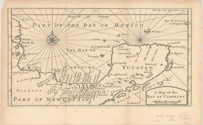
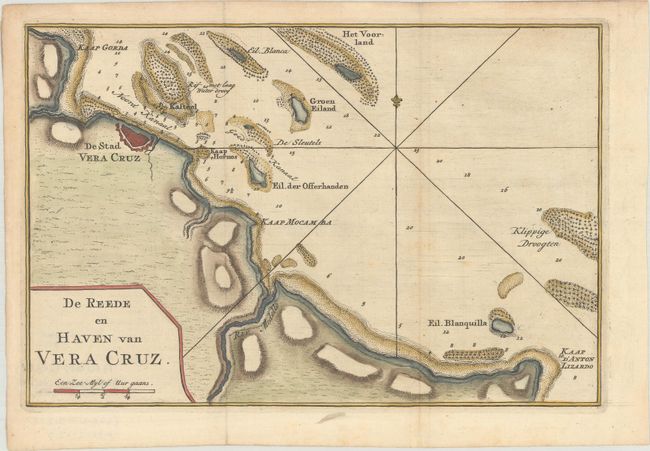
"[Lot of 2] A Map of the Bay of Campechy [and] De Reede en Haven van Vera Cruz",

Subject: Southeast Mexico

Period: 1699-1769 (circa)

Publication:

Color:

Size:
See Description
Download High Resolution Image
(or just click on image to launch the Zoom viewer)

A. A Map of the Bay of Campechy, by Herman Moll, from A New Voyage Round the World..., circa 1699, black & white (10.9 x 5.8"). This is a scarce map of the Bay of Campeche and the Yucatan Peninsula. It covers the region first explored in 1517 by Fernando de Cordoba and Antonio de Alaminos and visited by Dampier twice prior to his circumnavigations. The city of Campeche, on the west coast of the Yucatan Peninsula, derives its name from the Mayan city of Ah-Kin-Pech. The Sacrificious I. (Island of Sacrifices), located just offshore from Veracruz, is the location of a prominent Aztec temple discovered by the Spanish in 1518. There are no place names along the coastline now known as Riviera Maya, but Cozumel Island is named and the city of Valladolid is located.

William Dampier (1652-1715) was a soldier, buccaneer, pirate, British navy captain, and hydrographer. He was also among the most influential of travel writers. Dampier completed several circumnavigations between 1679 and 1691, during which he was among the first group of Englishmen to land in New Holland (Australia). Condition: A nice impression issued folding, now flat, on a sheet with an elaborate coat of arms watermark. There is minor toning, and a short fold separation at top right has been closed on verso with archival materials.

B. De Reede en Haven van Vera Cruz, by Isaac Tirion, from Hedendaagsche Historie, of Tegenwoordigestaat van Amerika, circa 1769, hand color (10.3 x 6.8"). This chart shows the important port of Veracruz in the Gulf of Mexico. Veracruz was the first port established in New Spain by Hernan Cortes in 1519, and later was a scene of many battles during the ensuing years. The chart depicts the islands, rocks, shoals, and soundings in the surrounding waters to aid in navigation. Tirion's Hedendaagsche Historie was initially conceived as the Dutch edition of Thomas Salmon's Modern History. The work began in 1729, but the text was later expanded and the Hedendaagsche Historie was therefore not completed until 1803. Condition: Issued folding, now flat, on watermarked paper with some light scattered foxing and printer's ink residue.

References: Shirley (BL Atlases) G.DAM-1a #7 & G.TIR-1a #4.

Condition: B+

See description above.

Estimate: $220 - $250

Sold for: $140

Closed on 4/28/2021

Archived