Catalog Archive
Auction 182, Lot 363

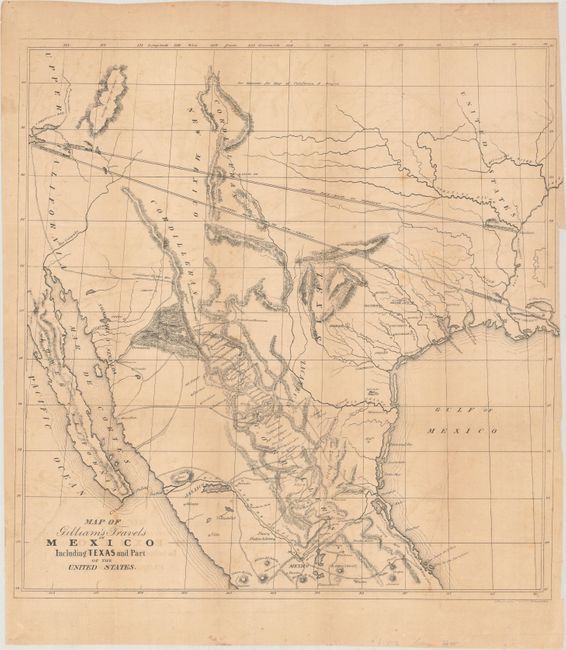
"Map of Gilliam's Travels in Mexico Including Texas and Part of the United States",

Subject: Southwestern United States & Mexico, Texas

Period: 1846 (circa)

Publication: Travels Over the Table Lands and Cordilleras of Mexico

Color: Black & White

Size:
18.8 x 19.2 inches
47.8 x 48.8 cm
Download High Resolution Image
(or just click on image to launch the Zoom viewer)

This uncommon map was issued in Albert Gilliam's Travels Over the Table Lands and Cordilleras of Mexico and features the Republic of Texas. The map is remarkable for its depiction of two possible Pacific railroad routes originating from New Orleans and Napoleon, Arkansas (near the confluence of the Arkansas and Mississippi rivers). While Gilliam's ideas were visionary for the time (predating the Pacific Railroad surveys of the 1850s), they completely ignored any reality of topographical features and were simply drawn "as the crow flies." In addition to the two proposed railroads, the map nicely details Gilliam's route from San Francisco through Mexico, with a number of mines located and identified. Lithographed by Thomas Sinclair in Philadelphia.

References: Wheat (TMW) #510; Wagner-Camp #120C; Howes #G-179; Sabin #27412.

Condition: B

There is light toning and offsetting, a few spots of foxing, and a 2.5" binding tear at right that has been closed on verso with archival tape.

Estimate: $200 - $230

Sold for: $75

Closed on 4/28/2021

Archived