Catalog Archive
Auction 182, Lot 354

First Edition of Arrowsmith's Folio Map of the Southwest

"Mexico", Arrowsmith, John

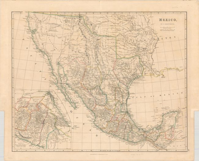
Subject: Southwestern United States & Mexico, Texas

Period: 1832 (dated)

Publication: The London Atlas of Universal Geography

Color: Hand Color

Size:
23.7 x 19 inches
60.2 x 48.3 cm
Download High Resolution Image
(or just click on image to launch the Zoom viewer)

This is the first edition of Arrowsmith's folio-sized map of southwestern United States, Texas and Mexico, and was published four years prior to Texas gaining independence from Mexico. In Upr. or New California, there is an American Fur Co. Depot on the eastern shore of Youta or Gt. Salt L. The Great Spanish Road is shown extending from the Red River on the U.S.-Mexico boundary and past Santa Fe to Nutrias. A note through present-day New Mexico states that the area is "frequented by roving bands of Indians who roam about in the quest of game." A large inset depicts central Mexico, centered on Mexico City and showing the important ports of Acapulco, Vera Cruz and Tampico.

References:

Condition: B+

There is some faint scattered foxing and a short centerfold separation that just enters the border at bottom that has been closed on verso with archival tape.

Estimate: $750 - $900

Sold for: $900

Closed on 4/28/2021

Archived