Catalog Archive
Auction 182, Lot 296

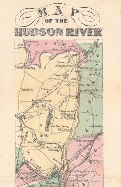
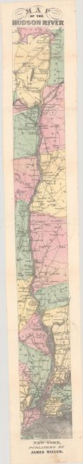
"Map of the Hudson River", Miller, James

Subject: New York

Period: 1866 (circa)

Publication: Miller's New York As it Is...

Color: Hand Color

Size:
2.9 x 23.1 inches
7.4 x 58.7 cm
Download High Resolution Image
(or just click on image to launch the Zoom viewer)

This small strip map was issued in Miller's New York As it Is and covers the course of the Hudson River from its mouth at New York Harbor and extending north to above Albany including Luzerne and Jesups Landing. It presents numerous place names along the river, locates roads, railroads, and forts, and identifies the site of General Borgoyne's surrender at Bemis Heights. Engraved by T. Bonar and published by James Miller. Housed in a pocket adhered to quarter leather modern boards (4.7 x 5.0").

References:

Condition: A

Issued folding with minor foxing in the top and bottom blank margin. Modern boards are near fine.

Estimate: $180 - $220

Unsold

Closed on 4/28/2021

Archived