Catalog Archive
Auction 182, Lot 24

"Nav War Map No. 6 - We Fight a Global War", U.S. Navy Dept.

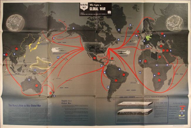
Subject: World, World War II

Period: 1944 (dated)

Publication:

Color: Printed Color

Size:
57.3 x 38.2 inches
145.5 x 97 cm
Download High Resolution Image
(or just click on image to launch the Zoom viewer)

This very large pictorial map was issued by the Educational Services Section of the U.S. Navy. One of the division's primary goals was to inform American service members of the status of the war and to provide context for the battles they would be supporting. The map covers the entire world with an emphasis on the oceans, showing major supply lines from the United States to the Allies abroad. The locations of U.S. Armed Forces are shown with stars, while the Axis nations are highlighted in yellow (Japan) and green (Germany). Two smaller maps occupy the top corners of the sheet and show air distances between locations in the Pacific Ocean and the Arctic region joining North America with Russia and Europe. An interesting graphic below the map reveals that 70% of the supplies sent abroad go either to the United Kingdom or Russia. Related text at bottom states that "in this global war the world's largest Navy speaks with authority."

References:

Condition: B+

Vivid color on a clean sheet with short separations mostly at the fold junctions with minute loss of image.

Estimate: $550 - $700

Sold for: $900

Closed on 4/28/2021

Archived