Catalog Archive
Auction 182, Lot 166

"Mapa Geografico que Comprehende la Nueva Inglaterra, Nueva York, Nueva Jersey, Pensilvania, Maryland y Parte de Virginia", Lopez, D. Tomas

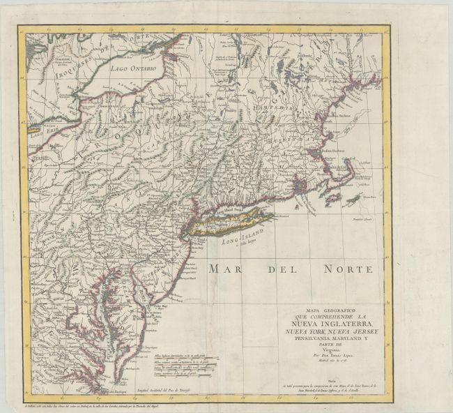
Subject: Colonial New England United States

Period: 1778 (dated)

Publication:

Color: Hand Color

Size:
15 x 15.3 inches
38.1 x 38.9 cm
Download High Resolution Image
(or just click on image to launch the Zoom viewer)

This is one of the rare Spanish maps of the United States outside of those regions formerly colonized by the Spanish. It was issued during the American Revolution and shows the region from southern Maine to the Chesapeake and west to include part of Lake Erie. New York is identified along the Hudson River with a huge area of upstate New York labeled Iroqueses. Numerous forts are located to the south of Lake Champlain including Fort Miller, Edward, Hardy and Hunter. Maine is identified in a smaller font as Mayn. The map is acknowledged to be based on those of Evans, Mitchell, Jeffreys, and d'Anville. Longitude is from El Hierro, the smallest and southernmost of the Canary Islands.

References: McCorkle #778.7; Shirley (BL Atlases) T.LOP-3a #2, Vol 2.

Condition: B+

A sharp impression on a bright sheet with an "RRVMEV" watermark and minor soiling. A tear that extends 5" into the image at bottom center within the Atlantic Ocean has been professionally repaired.

Estimate: $700 - $850

Unsold

Closed on 4/28/2021

Archived