Catalog Archive
Auction 181, Lot 89

"Isle et Banc de Terre-Neuve, Isle Royale et Isle St. Jean; avec l'Acadie ou la Nouvelle Ecosse", Bonne, Rigobert

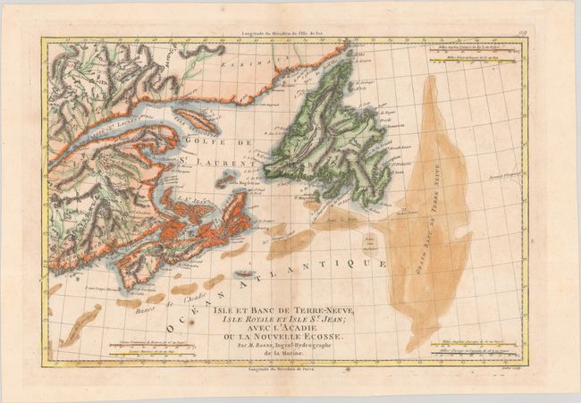
Subject: Eastern Canada

Period: 1788 (circa)

Publication: Atlas Encyclopedique

Color: Hand Color

Size:
13.6 x 9.2 inches
34.5 x 23.4 cm
Download High Resolution Image
(or just click on image to launch the Zoom viewer)

This handsome map covers the Maritimes and Newfoundland, with good detail of the fishing banks int he North Atlantic. It features nice topographical detail and six distance scales. Engraved by Andre and published in Atlas Encyclopedique, Contenant la Geographie Ancienne by Bonne and Desmarest.

References: Kershaw #730.

Condition: B+

Modern color on watermarked paper with a small hole near the center of the image and light toning along the centerfold.

Estimate: $120 - $150

Sold for: $90

Closed on 2/10/2021

Archived