Catalog Archive
Auction 181, Lot 745

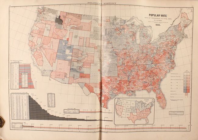
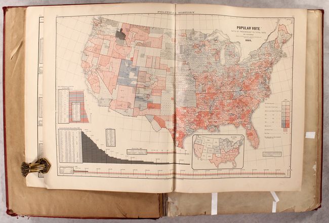
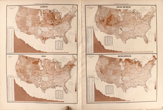
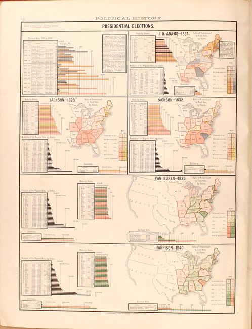
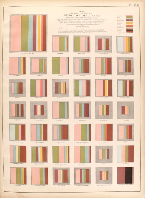
A Fascinating Volume Dedicated to Thematic Mapping

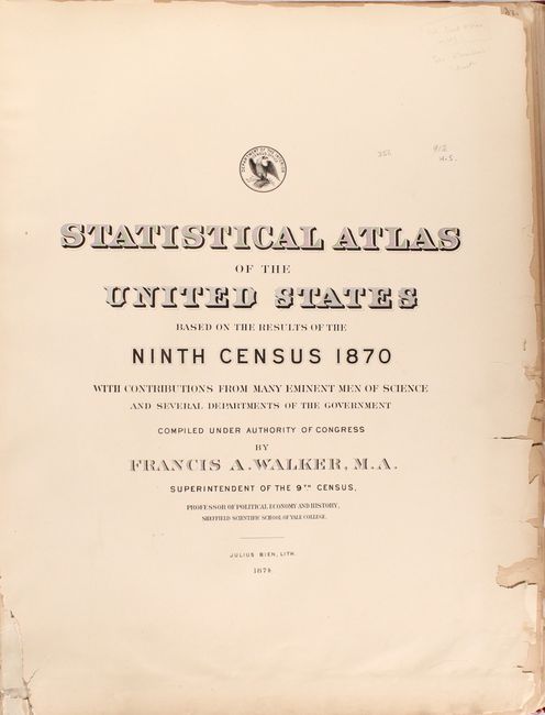
"Citizen's Atlas of American Politics 1789-1888... [bound with] Statistical Atlas of the United States Based on the Results of the Ninth Census",

Subject: Atlases

Period: 1874-88 (published)

Publication:

Color: Printed Color

Size:
17.2 x 22 inches
43.7 x 55.9 cm
Download High Resolution Image
(or just click on image to launch the Zoom viewer)

This volume contains two atlases in one. At the front is the Citizen's Atlas of American Politics, which aimed to "illustrate the exhaustive, yet simple and easily comprehended graphic exhibits of the general work, which cover the entire material, economic and political development of the Nation." It contains a total of 5 double-page and 6 single-page maps showing voting history, population, agriculture and trade. The maps are accompanied by several pages of statistical tables on trade and wages along with a fascinating history of American political parties. Bound in paper wrappers (still present) and published by Charles Scribner's Sons in New York. Condition: Maps and charts are mostly clean and bright. There is an old library stamp on the verso of the title page. Paper wrappers are heavily worn along with some ink spots. (B+)

Accompanying the Citizen's Atlas is the first statistical atlas of the United States. It is complete with fifty-four plates, mostly double-page maps, providing a view of the physical, economic, and social geography of the United States. Most maps are colorful and thematic in nature including the desirable Geological Map of the United States by Hitchcock. Of special interest are the maps that show the population density for each decennial census from 1790 to 1870. Schwartz & Ehrenberg commend this atlas saying it was a "pioneering work [and] was the first atlas of analytical maps that showed the patterns of associations and it greatly influenced the development of thematic mapping in the Untied States." Francis A. Walker was the Superintendent of the Ninth Census and Professor of Political Economy and History in the Sheffield Scientific School at Yale College. Condition: Maps are fair to very good with numerous short edge tears that have been closed on verso with hinge tape (mostly in the first half of the atlas). Text is moderately toned and very brittle with numerous edge chips and tears throughout. Title page is loose and there is an old library stamp on the verso of the frontispiece. (C+)

Elephant Folio. Hardbound in maroon cloth with gilt title on spine.

References:

Condition:

See description above for individual atlases. The binding is soiled and worn, especially along the edges, and the spine is chipped at the ends. A former owner's bookplate is on the front pastedown (binding - B).

Estimate: $550 - $700

Sold for: $375

Closed on 2/10/2021

Archived