Catalog Archive
Auction 181, Lot 608

"[Title on Verso] Asiae Tabula Secunda Continet Sarmatiam Asiaticam", Ptolemy/Fries

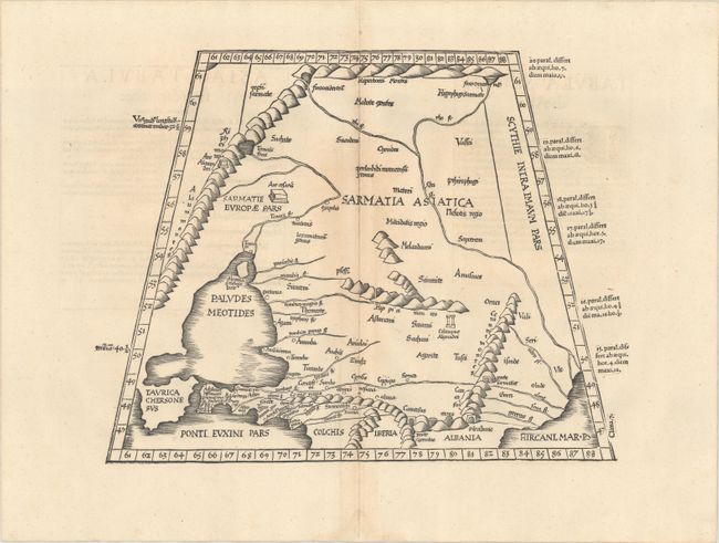
Subject: Caucasus & Southwestern Russia

Period: 1541 (published)

Publication: Claudii Ptolemaei Alexandrini Geographicae…

Color: Black & White

Size:
15.6 x 12 inches
39.6 x 30.5 cm
Download High Resolution Image
(or just click on image to launch the Zoom viewer)

Claudius Ptolemy was a mathematician, astronomer and geographer who worked in Alexandria, then a part of the Roman Empire, in the 2nd century AD. One of the most learned and influential men of his time, his theories dominated both astronomy and geography for nearly 1500 years. His writings were kept alive by Arabic scholars during the Middle Ages and reemerged in Europe during the Renaissance. The birth of printing led to wide dissemination of his great works on astronomy and geography. There were a number of editions of his Geographia beginning in 1477. These early editions contained maps based on his original writings, known as Ptolemaic maps. As geographic knowledge increased with the explorations of Columbus, Magellan, Cabot and others, maps of the New World were added, and maps of the Old World were revised. Ptolemy's Geographia continued to be revised and published by some of the most important cartographers including Martin Waldseemuller, Sebastian Munster, Giacomo Gastaldi, Jodocus Hondius, and Gerard Mercator (whose last edition was published in 1730).

This lovely map covers the region north of the Black and Caspian Seas as far as the Hyperborie Montes. The woodcut map from the blocks of Laurent Fries is based on the work of Waldseemuller. Geographically the map is classic Ptolemy, trapezoid in outline with convoluted mountain ranges. This edition was printed by Gaspar Treschel and edited by Michael Villanovus (known as Servetus). Servetus was charged with heresy by John Calvin in 1553, in part due to the text in this atlas. The courts found him guilty and sentenced him to burning at the stake, atop a pyre of his own books, including this atlas.

References: Mickwitz & Miekkavaara #211-16.

Condition: A

On sheet with a bunch of grapes watermark. There are a couple printer's creases and minor toning around the centerfold.

Estimate: $275 - $350

Sold for: $160

Closed on 2/10/2021

Archived