Catalog Archive
Auction 181, Lot 577

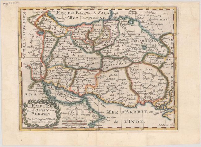
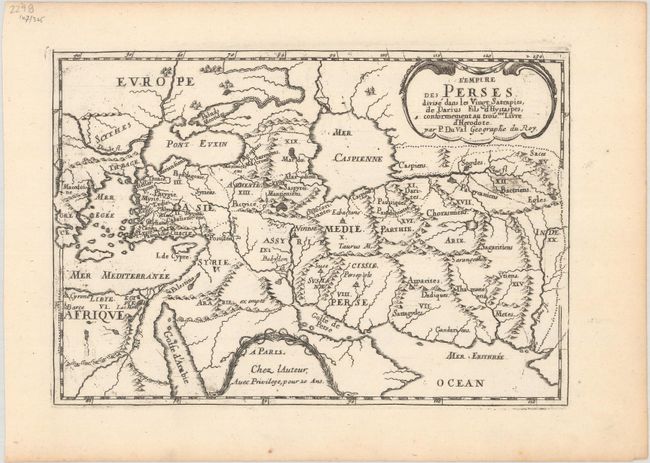
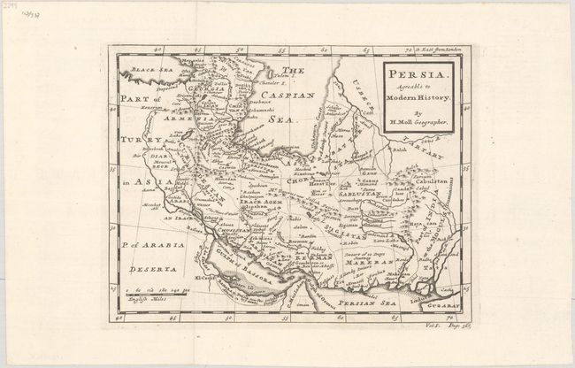
"[Lot of 3] L'Empire du Sophy des Perses [and] L'Empire des Perses Divise dans les Vingt Satrapies... [and] Persia Agreable to Modern History",

Subject: Middle East, Persia

Period: 1677-1744 (circa)

Publication:

Color:

Size:
See Description
Download High Resolution Image
(or just click on image to launch the Zoom viewer)

A. L'Empire du Sophy des Perses, by Nicolas Sanson, circa 1683, hand color (9.6 x 7.4"). This is a reduced version of Sanson's map of the Persian Empire covering the region of present-day Kuwait, Iraq, and Iran with a part of the Arabian Peninsula. The map extends east to the mouth of the Indus River and is filled with cities, political divisions, and topographical details. Engraved by Antoine d' Winter and decorated with a laurel wreath-style cartouche.

Sanson's small maps from his L'Asie en Plusieurs Cartes..., first published in 1652 and engraved by A. Peyrounin, were copied several times by various map publishers. Johann David Zunners made copies of Sanson's maps for his German translation of Die Gantze Erd-Kugel in 1679. Johannes Ribbius and Simon de Vries published copies in 1682 and 1683, with new maps engraved by Antoine d'Winter. The plates were later sold to Francois Halma, who used them in 1699 and then again in 1705 with the titles re-engraved in Dutch. The titles on the d'Winter plates were re-engraved back into French, and then used by Nicholas Chemereau in 1715 and by Henri du Sauzet in 1738. Condition: A nice impression issued folding, now flat. There are a few edge tears and some chips in the margins that have been professionally repaired.

B. L'Empire des Perses Divise dans les Vingt Satrapies, de Darius Fils d'Hystaspes, Conformement au Troisme Livre d'Herodote, by Pierre Duval, from Diverses Cartes et Tables pour la Geographie Ancienne..., published 1677, black & white (9.1 x 6.3"). This handsome and uncommon small map extends from Greece to the Indus River. It features ancient place names and political divisions. The Caspian Sea is presented in a squat and rounded configuration. The map is adorned with two cartouches, one showing the title and the other the privilege. Reference: Pastoureau, DUVAL VII Ba [8]. Condition: A sharp impression on watermarked paper with some printer's ink residue.

C. Persia Agreable to Modern History, by Herman Moll, from Modern History: or the Present State of All Nations..., circa 1744, black & white (10.1 x 7.8"). This detailed map covers the region from the Black Sea east to the Indus River. Depicts the numerous mountains in the area, the river systems, and is filled with place names. Reference: Shirley (BL Atlases) G.SALM-1c #9. Condition: A crisp impression issued folding on paper with a bunch of grapes watermarked with wide margins.

References:

Condition: A

See description above.

Estimate: $200 - $230

Sold for: $110

Closed on 2/10/2021

Archived