Catalog Archive
Auction 181, Lot 441

"Pomeraniae Wandelicae Regionis Tipus", Ortelius/Galle
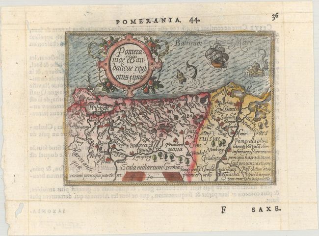
Subject: Baltic

Period: 1579 (published)

Publication: Le Miroir du Monde

Color: Hand Color

Size:
4.3 x 3.1 inches
10.9 x 7.9 cm
Download High Resolution Image
(or just click on image to launch the Zoom viewer)

Charming miniature map of the historic region of Pomerania on the shores of the Baltic Sea. It includes present-day Poland with the Vistula delta, Rostok and Germany to the west, and Belarus to the east. The tiny map is decorated with a nice cartouche, two sea monsters and a sailing ship. French text on verso.

This map is from the first pocket-sized atlas, Spieghel der Wereld, which was based on Ortelius' Theatrum Orbis Terrarum. The maps were engraved on copper by Filips Galle and represented all regions around the world. The maps were accompanied by text prepared by Peter Heyns, who used the text from the Theatrum. The numbers printed above the maps, adjacent to the letterpress title, indicate the number of the map within the Theatrum. This innovative, small atlas was designed to reach the lower middle class, and was a commercial success, prompting numerous reprints and imitations. The first edition of the Spieghel der Wereld was published in 1577, with subsequent editions published in French in 1579 and 1583, Dutch in 1583 and 1596, and Latin in 1585. One unique feature of this pocket atlas was the inclusion of 6 larger, fold-out maps of the world, Europe, France, Germania, the Low Countries and Italy that were included alongside 66 miniature maps.

References: King (2nd Ed.) pp. 60-61; Van der Krogt (Vol. III) #2190:331.

Condition: A

A crisp impression on a bright sheet with several small worm tracks in the blank margins and one along the neatline at top right.

Estimate: $110 - $140

Sold for: $80

Closed on 2/10/2021

Archived