Catalog Archive
Auction 181, Lot 339
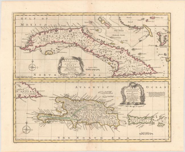
"A New & Accurate Map of the Island of Cuba. Drawn from the Most Approved Maps & Charts and Regulated by Astronl. Observations [on sheet with] A New & Accurate Map of the Islands of Hispaniola or St. Domingo, and Porto Rico...", Bowen, Emanuel
Subject: Greater Antilles
Period: 1747 (circa)
Publication: A Complete System of Geography...
Color: Hand Color
Size:
16.6 x 13.7 inches
42.2 x 34.8 cm
Download High Resolution Image
(or just click on image to launch the Zoom viewer)
(or just click on image to launch the Zoom viewer)