Catalog Archive
Auction 181, Lot 334

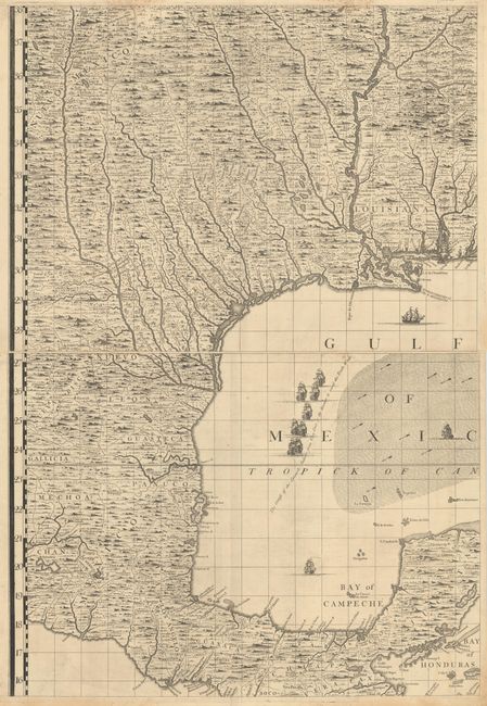
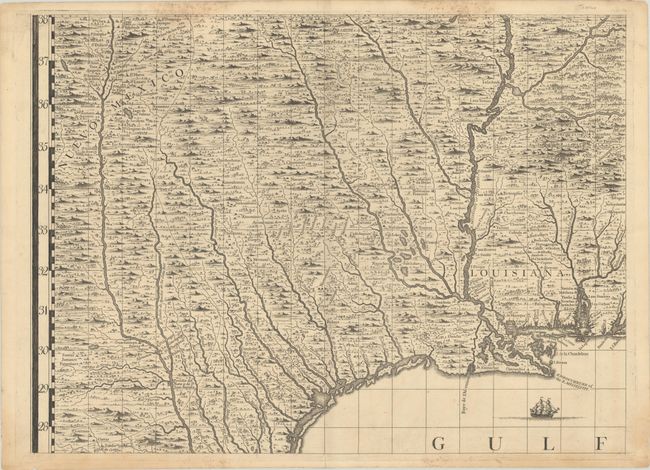
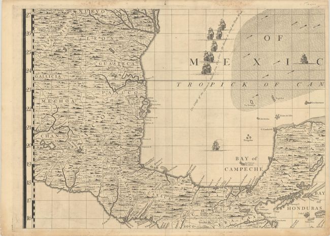
Popple's Epic Map - Gulf Coast Sheets

"[Lot of 2 - A Map of the British Empire in America (Sheets 9 & 13) - Texas, Louisiana, & Mexico]", Popple, Henry

Subject: Gulf of Mexico & Caribbean, Texas

Period: 1733 (published)

Publication:

Color: Black & White

Size:
26 x 19.3 inches
66 x 49 cm
Download High Resolution Image
(or just click on image to launch the Zoom viewer)

These two sheets together cover the Gulf coast from Pensacola through Louisiana, Texas, Mexico, to the Bay of Honduras, presenting a complete picture of this important region in fine detail. Popple consulted French sources for mapping this region including Delisle's 1718 Carte de la Lousiane et du Cours du Mississipi. Major rivers dominate the interior of these maps including the course of the Mississippi, Ohio, Nueces and Rio Grande. Pictorial forests and topography fill the gaps between scores of Indian villages and settlements including Cenis, Teijas, and the numerous missions along the upper Rio Grande including Santa Fe (no mention of New Orleans here like Delisle's first map). In the waters, shoals, offshore islands, and trade winds are notes along with a number of ships demonstrating "the course of the Spanish Galleons from Vera Cruz to the Havana to avoid the Trade Winds."

Henry Popple based his map on firsthand information gathered over several years at the Board of Trade and Plantations. The map was the first large-scale British map to provide an overall view of the eastern half of North America. As tensions grew between the colonial powers, the map became immensely influential throughout Europe and was copied by several cartographers. This is an early state printed on sturdy paper with no page number in top margin.

References: Pritchard & Taliaferro #24; Cumming (SE) #216; McCorkle #733.1.

Condition: B+

Strong impressions on watermarked paper with light staining along the top sheet edges. Sheet 9 has a 3" centerfold separation at bottom and Sheet 13 has a 2.5" separation at bottom. The first image is a composite image - the map is in 2 separate sheets.

Estimate: $3,000 - $4,000

Sold for: $1,750

Closed on 2/10/2021

Archived