Catalog Archive
Auction 181, Lot 331

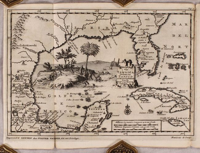
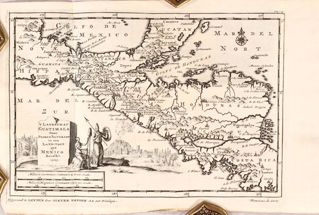
"[2 Maps with Disbound Text] Scheeps Togt van Iamaica Gedaan na Panuco en Rio de las Palmas Aan de Golf van Mexico Gelegen [and] 'T Landschap Guatimala Door Pedro D'Alvarado in een Land-Togt uyt Mexico Bevolkt", Aa, Pieter van der

Subject: Gulf of Mexico & Caribbean, Mexico & Central America

Period: 1707 (published)

Publication:

Color: Black & White

Size:
9 x 6 inches
22.9 x 15.2 cm
Download High Resolution Image
(or just click on image to launch the Zoom viewer)

These two maps are bound into a disbound section of one of Van der Aa's extensive exploration volumes focused on the West Indies, Mexico and Central America:

A. Scheeps Togt van Iamaica Gedaan na Panuco en Rio de las Palmas Aan de Golf van Mexico Gelegen. This attractive small map covers the coastal regions from South Carolina and Florida through Texas and Mexico to include the Yucatan peninsula. It also covers the Bahamas, Cuba and Jamaica. Place names are scattered throughout, with emphasis in Mexico. The Mississippi River is named R. de Spiritu Santo. The map is based on the reports from the expedition of Alonso Alvarez de Pineda, who explored the region in 1518-19 for Francisco de Garay, Governor of Jamaica. Garay sent three expeditions to the region. In 1523 Garay lost his fortune and then his life in a personal dispute with Cortes for control of the Panuco region. Condition: A dark impression with faint offsetting and a short fold separation at lower left that just passes the neatline. (B+)

B. 'T Landschap Guatimala Door Pedro D'Alvarado in een Land-Togt uyt Mexico Bevolkt. This small map shows the lands conquered under Spanish conquistador Pedro de Alvarado, extending from southern Mexico and the Yucatan south through Guatemala, Nicaragua, and portions of Costa Rica. There is good coastal detail and the interior is filled with numerous towns and villages, river systems, and pictorial topography. Decorated by a title cartouche featuring Indian warriors, a fortified city, and an erupting volcano. Condition: A dark impression on a clean sheet. (A)

The maps are augmented by four sections of disbound text including 11 beautifully engraved views depicting scenes of battles, ceremonies and everyday life. 12mo.

References:

Condition:

See description above for condition of maps. Plates and disbound text are very good with light toning. One of the title pages has cello tape along the left sheet edge.

Estimate: $400 - $475

Sold for: $400

Closed on 2/10/2021

Archived