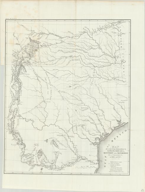
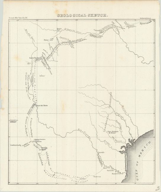
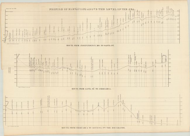
"Map of a Tour from Independence to Santa Fe, Chihuahau, Monterey and Matamoros [with report and 2 other plates]", Wislizenus, Frederick Adolphus (Dr.)
1 of 5
Subject: South Central United States & Mexico, Texas
Period: 1848 (published)
Publication: Sen. Misc. No. 26, 30th Congress, 1st Session
This is a fascinating map of the early state of Texas during the Mexican-American War that Wheat says is "of considerable value ... A number of routes to New Mexico and across Texas are shown, and Doniphan's campaign is carefully followed from Independence, through New and old Mexico to ... near the mouth of the Rio Grande." Frederick Adolphus Wislizenus, an adventurous doctor from St. Louis, undertook and funded a scientific expedition into Texas, New Mexico and northern Mexico in 1846. When he set out he did not realize that war had just been declared between the United States and Mexico. This map shows his route along the Santa Fe Trail, by the Cimarron route, from Missouri to Santa Fe, then following the Rio Grande south to El Paso, through northern Mexico and ending in Matamoros where he was imprisoned for six months. When freed, he joined Colonel Doniphan’s expedition, providing service as a doctor on the trip home. The map shows the route with a key indicating towns and villages, night camps, haciendas and ranchos, as well as astronomical observations.
Accompanying the map is the original report "Memoir of a Tour to Northern Mexico, Connected with Col. Doniphan's expedition, In 1846 And 1847." 141 pages, folding profile and 2 folding maps. First edition. Octavo, rebound in quarter faux leather over cloth boards. Printed by Tippin & Streeper, Washington, D.C. The report and tour map were the most comprehensive account of the region published during this period.