Catalog Archive
Auction 181, Lot 28

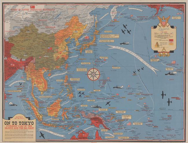
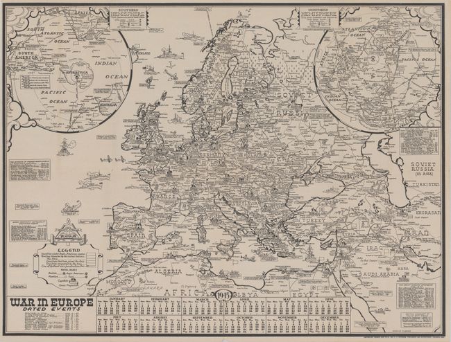
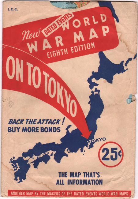
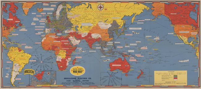
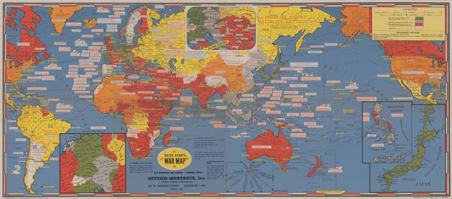
"[Lot of 3] Dated Events - On to Tokyo - Invasion Map of the Pacific and Far East [on verso] War in Europe - Dated Events [and] Dated Events War Map [17th Edition] [and] Dated Events War Map [25th Edition]", Turner, Stanley

Subject: World, World War II

Period: 1944-45 (dated)

Publication:

Color: Printed Color

Size:
See Description
Download High Resolution Image
(or just click on image to launch the Zoom viewer)

This lot features three distinctive World War II maps by Stanley Turner:

A. Dated Events - On to Tokyo - Invasion Map of the Pacific and Far East, [on verso] War in Europe - Dated Events, dated 1944 (25.8 x 19.6"). This colorful map depicts the Pacific theater of war and is distinctive for its comprehensive depiction of the war to date with many battles and engagements shown by date. Includes a legend identifying areas of control by Japanese and Anglo-American forces. Decorated by a large compass rose at center, legend featuring the United States seal, and numerous ships and aircraft in/over the water. The verso contains an equal size map showing the War in Europe with similar details. Folds into a pictorial paper envelope (7.0 x 10.2"). Published by C.C. Petersen, who typically sold the maps to other companies who added their advertising and distributed the maps as giveaways (including the two maps below). Reference: Rumsey #10010. Condition: Folding map is very good with some light wear along the fold lines. Envelope has some dampstains in the corners and a small tear. (B+)

B. [Lot of 2] Dated Events War Map [17th Edition], dated 1944 (38.5 x 16.8") [and] Dated Events War Map [25th Edition], dated 1945 (38.5 x 16.8"). These two world maps were published by C.C. Petersen and given away by the Smallcomb Electric Company (17th edition) and Gettier-Montanye, Inc. (25th edition). Both are dramatically colored and illustrated, demonstrating the progression of the war from 1944 to 1945. The maps are color-coded to show regions under Axis or Allied control. Particularly noteworthy when comparing this pair is the contraction of Axis control in mainland Europe as the Allied forces surround Nazi Germany. Blank versos. Condition: Issued folding with minor soiling and light wear along the fold lines. The second map (25th edition) has a 5" fold separation that has been closed on verso with archival tape.

For a brief article on the Turner maps, click here.

References:

Condition: B+

See description above.

Estimate: $200 - $250

Sold for: $375

Closed on 2/10/2021

Archived