Catalog Archive
Auction 181, Lot 19

"Carte Generale des Parties Connues du Globle", Mortier, Pierre
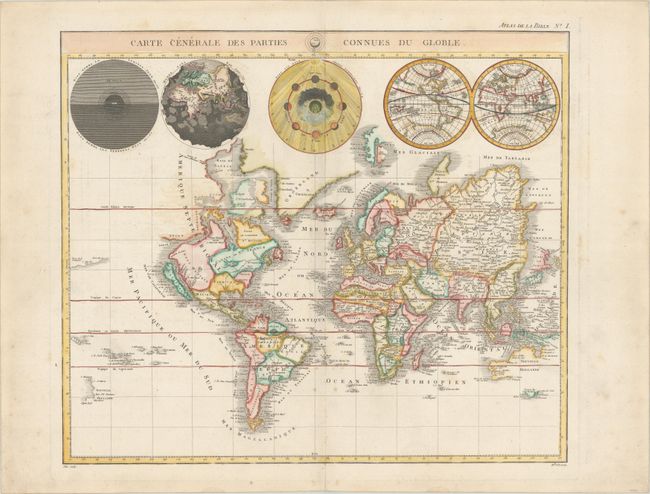
Subject: World

Period: 1809 (published)

Publication: Nouvel Atlas de la Bible…

Color: Hand Color

Size:
18.1 x 15.4 inches
46 x 39.1 cm
Download High Resolution Image
(or just click on image to launch the Zoom viewer)

This is a very uncommon version of Pierre Mortier's unique world map published by Jacques Desray. California is shown as an island, and the Detroit d'Anian connects by dotted lines through the Northwest Passage to Button's Bay, which is located to the west of Hudson Bay. In North America there is an erroneous large lake shown as the source for the Rio Norte, which flows southwest and empties into the Gulf of California. In the Great Lakes region there is a large open-ended lake named Mer Douce. The northeast coast of Asia is severely truncated and shows Witsen's Cap de Glaces. A small coastline of New Zealand appears in the Pacific. Australia's northern coast is shown connected to New Guinea, and two disjointed coastlines appear to the south including Van Diemen's Land. Five spheres are presented along the top, depicting Day and Night, the Flood, the phases of the moon, and the Western and Eastern Hemispheres. The map was precisely engraved by Mademoiselle Glot.

References: cf. Shirley #622.

Condition: B+

On a sturdy sheet with a bunch of grapes watermark, scattered foxing that is mostly confined to the blank margins, and minor toning.

Estimate: $700 - $850

Sold for: $500

Closed on 2/10/2021

Archived