Catalog Archive
Auction 181, Lot 183

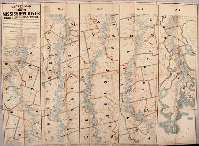
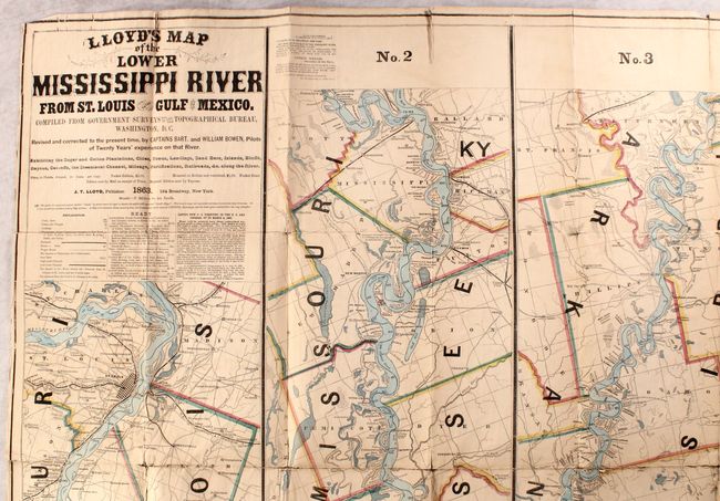
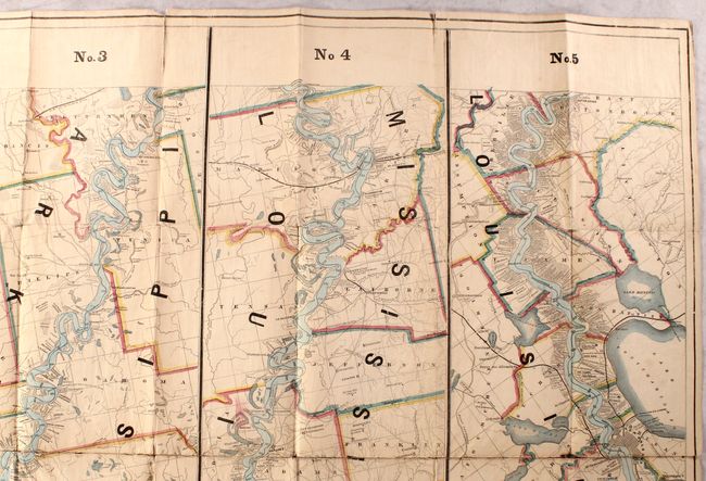
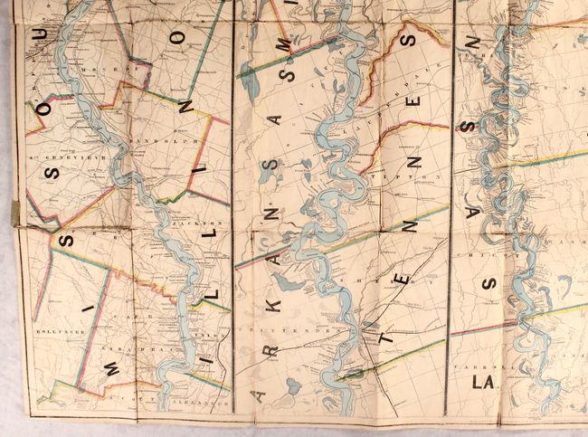
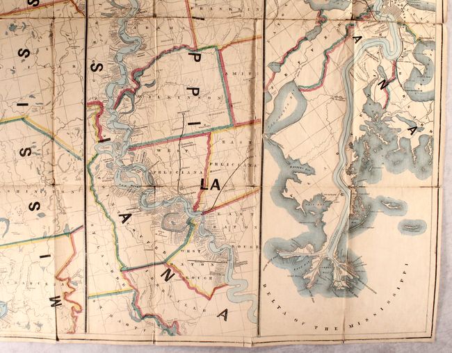
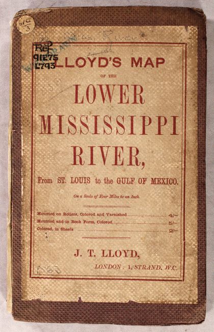
Rare Civil-War Era Strip Map of the Mississippi River

"Lloyd's Map of the Lower Mississippi River from St. Louis to the Gulf of Mexico. Compiled from Government Surveys in the Topographical Bureau, Washington, D. C.", Lloyd, James T.

Subject: Mississippi River

Period: 1863 (dated)

Publication:

Color: Hand Color

Size:
51.3 x 37 inches
130.3 x 94 cm
Download High Resolution Image
(or just click on image to launch the Zoom viewer)

This is a very rare pocket edition of this wall-sized strip map that follows the Mississippi River from its mouth to St. Louis. First published in 1862, the map includes several references to Civil War events from that year: "Destroyed by Gun Boats June 1862" (Warrenton); "Shelled by Gun Boats May 18, 1862" (Grand Gulf); Confederate batteries at Walnut Hill and Vicksburg; and "Johnsons [sic.] killed 1862" (near Warrenton). This example is the second edition, published one year later, and features a few updates. Most notably is the addition of "Grants Vicksburg Cut-Off," which refers to General Grant's failed attempt to widen the Williams Canal across the De Soto Peninsula in an effort to circumvent the Walnut Hills and Vicksburg batteries guarding the river. There were several changes also made to the text below the title, such as the elimination of a warranty statement ("Warranted correct, or the money refunded"), the addition of a legend for the map, and a cautionary statement regarding another publisher of "spurious 'Lloyd's maps'" that are "engraved coarsely" and "very erroneous."

Also of interest to this map is the connection to Samuel Clemens, i.e. Mark Twain, who apparently used this map as one of the sources for Adventures of Huckleberry Finn, according to a 2010 exhibit on the novel at CCA Wattis Institute for Contemporary Arts in San Francisco. Clemens had been a steamboat pilot on the Mississippi River from 1857 to 1861, and William Bowen, who is credited in the title as helping to revise the Lloyd map, was a childhood friend of Clemens.

The map is divided into 5 numbered strips, beginning with St. Louis at top left and ending with the Gulf of Mexico at bottom right. There is extensive detail of waterways, county and parish lines, roads and railroads, mines, forts, and towns of various sizes. Perhaps most importantly, however, are the names of landowners and the locations of their lots along the Mississippi River that are identified.

This map was available in three formats: this pocket edition, a sheet map, and a wall map on rollers. This pocket edition is mounted on original linen and folded into original brown cloth covers with paper title label printed in red ink, and original blue floral printed pastedown.

References: Modelski (Railroad Maps of US) #139; Phillips, America, p. 441; Rumsey #4472; Stephenson (Civil War) #41.

Condition: B

Bright contemporary color with minor toning and soiling. There are a number of splits in the paper along the folds, with a few tiny areas of loss, as well as several splits that continue through the linen along the edges of the map. There is a blindstamp for the Sondley Library at the bottom of strip No. 4. The front cover is worn and detached, with old cloth library tape still at the hinge and a "withdrawn" stamp covering the library call number written in ink at top left.

Estimate: $8,000 - $9,500

Sold for: $8,000

Closed on 2/10/2021

Archived