Catalog Archive
Auction 181, Lot 174

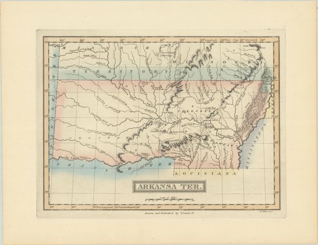
Rare First State of One of the Most Desirable Maps of Arkansas Territory

"Arkansa Ter.", Lucas, Fielding

Subject: South Central United States, Arkansas

Period: 1822 (published)

Publication: A General Atlas, of All the Known Countries in the World

Color: Hand Color

Size:
11.2 x 8.2 inches
28.4 x 20.8 cm
Download High Resolution Image
(or just click on image to launch the Zoom viewer)

Lucas’ map is one of only a few maps to show the territory in this configuration. In 1824 the first Reduction Act reduced the size of the territory and a second Reduction Act in 1828 created its final configuration. Indian tribes, villages, trading posts, salt works, and other early landmarks are shown, as well as the Cherokee and Osage Lines and the Choctaw Boundary. No counties are delineated with only a few settlements noted including Arkopolis, Hot Springs, and Pecan Point. The map also provides some detail of Missouri and Missouri Territory. Later issues of this map, from Lucas’ General Atlas Containing Distinct Maps..., have the title corrected to Arkansas Ter.

Fielding Lucas produced some of the finest American maps of the era, which were exquisitely engraved, printed on high quality paper, and attractively hand colored. There are no records of this state having been on the market, and according to Rumsey, there are only 2 known examples of the atlas containing this state of the map.

References: Rumsey #4866.057.

Condition: A+

Fine impression printed on quality paper with lovely contemporary color.

Estimate: $700 - $900

Sold for: $500

Closed on 2/10/2021

Archived