Catalog Archive
Auction 181, Lot 169

An Early, Detailed Depiction of the Gulf Coast

"Carte de la Louisiane par le Sr. D'Anville Dressee en Mai 1732. Publiee en 1752", Anville, Jean Baptiste Bourguignon d'

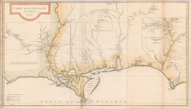
Subject: Colonial Southern United States

Period: 1752 (dated)

Publication:

Color: Hand Color

Size:
36.4 x 20.4 inches
92.5 x 51.8 cm
Download High Resolution Image
(or just click on image to launch the Zoom viewer)

This large and graphic map is one of the earliest detailed depictions of French settlements on the Gulf Coast. It extends along the coast from Cabo del Norte in the west to Cabo Escondido, and in the interior from Province de Tecas east to Apalachicola River in Florida. The map features very fine detail along the coast, particularly in the areas of New Orleans, Pasagoula, Mobile and Mobile Bay, Pensacola Bay (here Baye de Ste. Marie de Galbes), and St. Josephs Bay. Includes remarkably accurate mapping of the course of the Red, Mississippi, Pearl, Pascagoula, Tombigbee (Riviere des Tchicachas) and Alabama Rivers and tributaries. Numerous notes on Indian villages and forts are found in the interior. Includes the large inset "Partie Superieure de la Louisiane" that maps the course of the Mississippi River to it confluence with the Missouri and above. Due to the map's overwhelming popularity, it was frequently reprinted throughout the remaining years of French Louisiana. Printed on two sheets, joined as issued.

References: Phillips (Atlases) #571-35; Lemmon, Magill & Wiese #24.

Condition: B+

Issued folding on watermarked paper with faint toning along the fold lines. There is a tiny chip confined to the lower left blank margin and a small dampstain in the bottom blank margin.

Estimate: $1,500 - $1,800

Sold for: $1,400

Closed on 2/10/2021

Archived