Catalog Archive
Auction 181, Lot 142

"Karte von Luisiana dem Laufe des Mississipi und den Benachbarten Laendern", Bellin, Jacques Nicolas

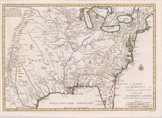
Subject: Colonial Eastern United States

Period: 1744 (dated)

Publication: Allegmeine Historie der Reisen zu Wasser und zu Lande

Color: Hand Color

Size:
22.1 x 15.5 inches
56.1 x 39.4 cm
Download High Resolution Image
(or just click on image to launch the Zoom viewer)

This is a scarce German issue of Bellin's map of Louisiana originally published in Charlevoix's Histoire. The finely engraved map covers the region from the Great Lakes to the Gulf of Mexico over to the Rocky Mountains and Santa Fe. The information in the west includes the road from Mexico City to Santa Fe and the routes of St. Denis and De Soto though Texas. The map shows strategic forts and areas claimed by the French just prior to the French and Indian War. Includes excellent detail of settlements, Indian tribes, rivers, and trails. Adorned by a compass rose in the Atlantic Ocean. Published in 1756.

References: Brown (Ohio) pp. 69-70; cf. McCorkle #744-1; cf. Tooley (MCC-96) #703.

Condition: A

Issued folding on a bright watermarked sheet. A binding trim at lower left has been replaced with old paper.

Estimate: $700 - $850

Sold for: $500

Closed on 2/10/2021

Archived