Catalog Archive
Auction 181, Lot 135

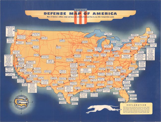
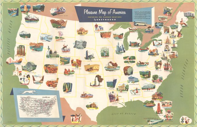
"[Lot of 2] Defense Map of America [and] Pleasure Map of America",

Subject: United States

Period: 1940-53 (circa)

Publication:

Color: Printed Color

Size:
See Description
Download High Resolution Image
(or just click on image to launch the Zoom viewer)

A nice pair of mid-20th century route maps issued by Greyhound Bus Lines:

A. Defense Map of America, circa 1940 (sheet size 23.7 x 18.0"). This map emphasizes the extensive Greyhound bus network, where "more of America's military camps and bases are served by Greyhound than by any other transportation system." Greyhound lines are delineated in bold red, connecting routes shown in dotted lines, and large military bases and forts are identified. Decorated by a compass rose featuring a Greyhound bus. Self-folding (4.0 x 9.0") with related text and illustrations on verso. Condition: Clean and colorful with a few tiny splits at the fold junctions. (A)

B. Pleasure Map of America, dated 1953 (27.2 x 17.5"). This attractive "pleasure map" features 45 illustrations of "the many features you may include in a Greyhound tour" including Giant Redwoods (California), Mt. Rushmore (South Dakota), and Mammoth Cave (Kentucky) to name a few. Small green dots on the map indicate where these attractions can be viewed en route and red dots indicate Greyhound travel bureaus. Includes at inset at bottom showing the complete Greyhound network. Verso contains descriptions of the 45 itineraries. Self-folding (4.0 x 9.0"). Condition: Fine. (A+)

References:

Condition:

Issued folding. See description above.

Estimate: $140 - $170

Sold for: $110

Closed on 2/10/2021

Archived