Catalog Archive
Auction 181, Lot 107

"A New and Accurate Map of the English Empire in North America Representing Their Rightful Claim as Confirm'd by Charters, & the Formal Surrender of Their Indian Friends...", Bennett, Richard

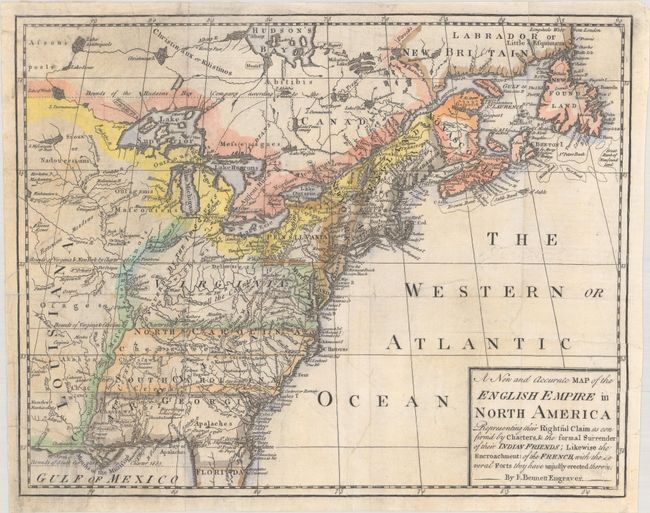
Subject: Colonial Eastern United States & Canada

Period: 1758 (published)

Publication: Grand Magazine of Universal Intelligence

Color: Hand Color

Size:
12.5 x 9.9 inches
31.8 x 25.1 cm
Download High Resolution Image
(or just click on image to launch the Zoom viewer)

A very scarce little map issued during the French and Indian War. The map is based on the map of the same title published by Herbert and Sayer for the Society of Anti-Gallicans in 1755. The map is a striking example of how maps were used for propaganda and illustrates by far the most pro-British representation of land claims in North America. The only French possessions on the continent are squeezed into the region, labeled Canada, along the St. Laurence River between Montreal and Tadoussac, and Anticosti, Prince Edward and Cape Breton Island and the north shore of Newfoundland. Published in the October 1758 edition of Grand Magazine of Universal Intelligence.

References: Jolly #GMUI-7.

Condition: B+

Issued folding on watermarked paper. The sheet has been flattened and professionally backed with tissue to repair a number of edge tears that extend 1-2" into the image at left and right.

Estimate: $800 - $950

Sold for: $600

Closed on 2/10/2021

Archived