Catalog Archive
Auction 180, Lot 99

"A Plan of Quebec, Metropolis of Canada. In North America", Anon.

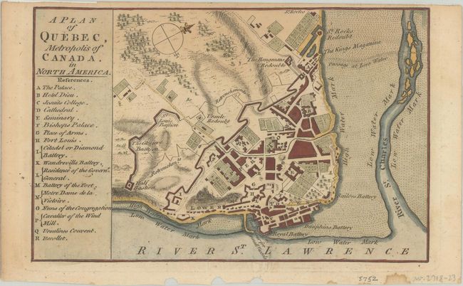
Subject: Quebec City, Canada

Period: 1759 (published)

Publication: London Magazine

Color: Hand Color

Size:
7.1 x 4.6 inches
18 x 11.7 cm
Download High Resolution Image
(or just click on image to launch the Zoom viewer)

This small map of Quebec City was published in the April 1759 edition of London Magazine, issued in the midst of the French & Indian War. Situated along the St. Lawrence River, the plan details the fortified city with a key at left identifying 17 strategic locations within its defenses including the palace, cathedral, citadel and several batteries. Along the outer wall is the Hangmans Redoubts, the Kings Magazine, and several bastions. North is oriented to the top right corner.

References: Jolly #LOND-164.

Condition: B+

Light toning along the top sheet edge with several tiny chips confined to the bottom blank margin.

Estimate: $100 - $130

Sold for: $80

Closed on 11/18/2020

Archived