Catalog Archive
Auction 180, Lot 94

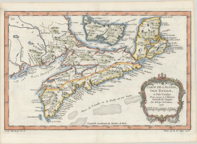
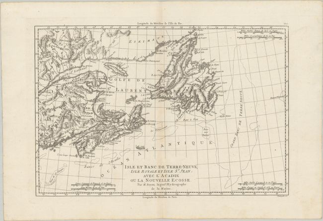
"[Lot of 2] Carte de l'Acadie, Isle Royale, et Pais Voisins. Pour Servir a l'Histoire Generale des Voyages [and] Isle et Banc de Terre-Neuve, Isle Royale et Isle St. Jean; avec l'Acadie ou la Nouvelle Ecosse",

Subject: Eastern Canada

Period: 1757 (circa)

Publication:

Color:

Size:
See Description
Download High Resolution Image
(or just click on image to launch the Zoom viewer)

A. Carte de l'Acadie, Isle Royale, et Pais Voisins. Pour Servir a l'Histoire Generale des Voyages, by Jacques Nicolas Bellin, from La Harpe's Histoire Generale des Voyages, dated 1757, hand color (13.1 x 8.3"). This strongly engraved map by Bellin covers all of Nova Scotia including Cape Breton. Prince Edward Island, here called Isle Saint Jean, is shown in good detail, and Nova Scotia is in part named as Acadie. South of Nova Scotia numerous banks are noted where 'la Pesche est tres bonne' (the fish are very good). The Micmac tribe is named near Shelburne. This map was published shortly after the 1755 expulsion of Acadians from this region. Although the Acadians were able to come back in 1764, many had settled in Louisiana and did not return. Reference: Kershaw #783. Condition: Minor offsetting.

B. Isle et Banc de Terre-Neuve, Isle Royale et Isle St. Jean; avec l'Acadie ou la Nouvelle Ecosse, by Rigobert Bonne, circa 1780, black & white (13.5 x 9.1"). This handsome map covers the Maritimes and Newfoundland. It features nice topographical detail and six distance scales. This is the uncommon edition engraved by Scattaglia. Condition: A crisp impression with faint toning along the centerfold.

References:

Condition: A

See description above.

Estimate: $220 - $250

Sold for: $275

Closed on 11/18/2020

Archived