Catalog Archive
Auction 180, Lot 39

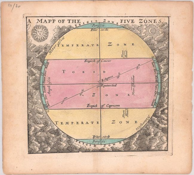
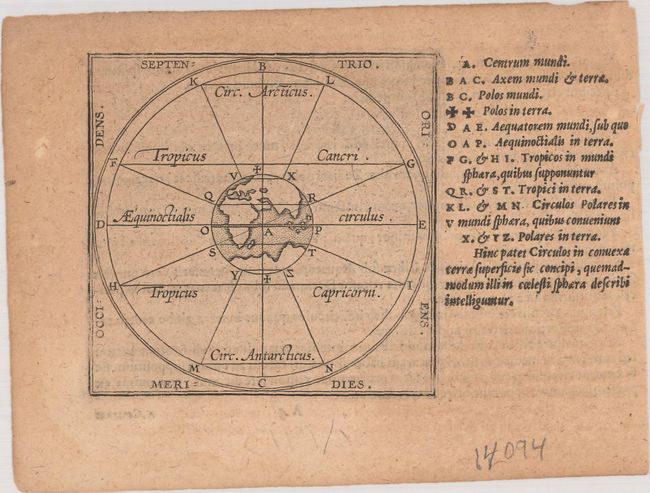
"[Lot of 2] A Mapp of the Five Zones [and] [De Circulis Minoribus]",

Subject: Cartographic Miscellany; Ancient World

Period: 1601-1700 (circa)

Publication:

Color:

Size:
See Description
Download High Resolution Image
(or just click on image to launch the Zoom viewer)

A. A Mapp of the Five Zones, by John Seller, from Atlas Terrestris, circa 1700, hand color (4.6 x 4.4"). This handsome miniature chart shows the five geographical regions of the world: the north frigid zone, the north temperate zone, the torrid zone, the south temperate zone, and the south frigid zone. It is surrounded by clouds and images of the sun and moon. Reference: Phillips (A) #529-III. Condition: Light damp stains barely enter into the engraved image at top left and top right. An edge tear that touches the neatline at right has been closed on verso with archival tape. (B+)

B. [De Circulis Minoribus], by Ortelius/Galle, from Epitome..., circa 1601, black & white (3.5 x 3.4"). This interesting little chart shows a map of the ancient world at center with a description of the circles of latitude. The climate zones are shown as Circ. Arcticus and Circ. Antarcticus, with the Tropic of Cancer and the Tropic of Capricorn noted as well. At the side, a legend locates via letters the center of the world and numerous other locations. Title is from verso. Additional Latin text and page "A5" on verso. Reference: King (2nd Ed.) pp. 64-65. Condition: On a toned sheet. (B)

References:

Condition:

See description above.

Estimate: $250 - $325

Sold for: $130

Closed on 11/18/2020

Archived