Catalog Archive
Auction 180, Lot 346

"Carte de Supplement pour les Isles Antilles", Bonne, Rigobert

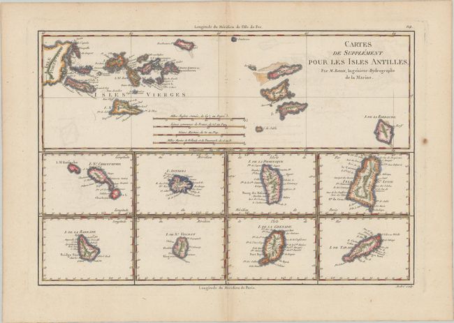
Subject: Lesser Antilles

Period: 1780 (circa)

Publication: Atlas Encyclopedique...

Color: Hand Color

Size:
13.8 x 9.3 inches
35.1 x 23.6 cm
Download High Resolution Image
(or just click on image to launch the Zoom viewer)

Includes nine maps on one sheet. The large map at top covers the Virgin Islands, while the maps at bottom include St. Christophe, L'Antigoa, I. De la Dominique, Isle de St. Lucie, I. De la Barbade, I. De St. Vincent, I. De la Grenade, and I. De Tabago. Engraved by Andre. This horizontally-oriented map is scarcer and larger than Bonne's similar map in a vertical orientation.

References:

Condition: B+

A dark impression on a watermarked sheet with light offsetting, minor toning along the centerfold, and a small paper flaw in the right blank margin.

Estimate: $180 - $210

Sold for: $90

Closed on 11/18/2020

Archived