Catalog Archive
Auction 180, Lot 294

"[Lot of 2] Johnson's New Map of the State of Texas [and] Texas",
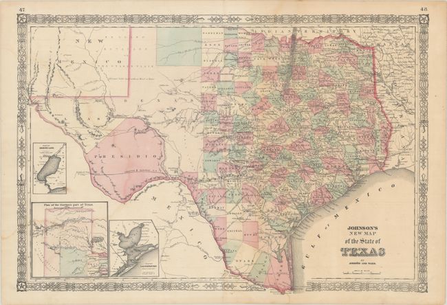
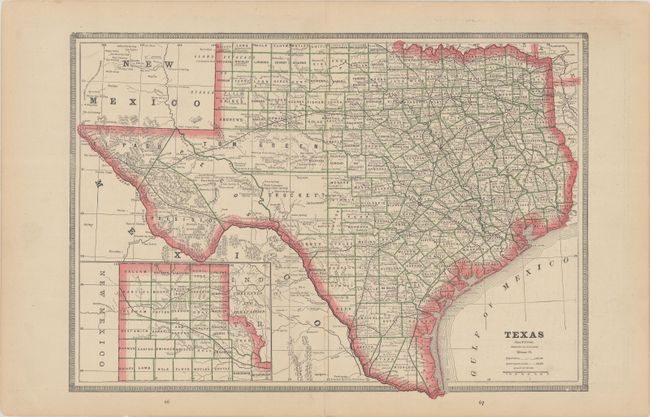
Subject: Texas

Period: 1864-80 (published)

Publication:

Color:

Size:
See Description
Download High Resolution Image
(or just click on image to launch the Zoom viewer)

A. Johnson's New Map of the State of Texas, by Johnson and Ward, from New Illustrated Family Atlas, published 1864-65, hand color (24.4 x 16.6"). This large, handsome map shows county development mostly in eastern Texas and only the three large counties of El Paso, Presidio, and Bexar in the west. The panhandle, noted as the El Llano Estacado or The Staked Plain (Elevated Table Land, without Wood or Water), includes a large section that is unorganized. The map features a nice depiction of the wagon roads, many named, with several completed railroads including the Houston & Guaymas R.R. Insets include Plan of Sabine Lake, Plan of the Northern Part of Texas, and Plan of Galveston Bay. Condition: Contemporary color with light dampstaining. An edge tear that just touches the border at top has been closed on verso with archival tape.

B. Texas, by George Cram, from Unrivalled Family Atlas,published 1880, printed color (17.0 x 12.1"). This is a detailed wax engraved map of the entire state with the panhandle in an inset. It reflects county development throughout the state with large interim counties still in West Texas. The map shows railroads, towns, forts and several interesting place names including Perry’s Landing where slaves were traded in the antebellum era. Maps of Arkansas and Indian Territory are on verso. Condition: A 3.5" centerfold separation at bottom has been closed on verso with archival tape.

References:

Condition: B+

See description above.

Estimate: $275 - $350

Sold for: $300

Closed on 11/18/2020

Archived