Catalog Archive
Auction 180, Lot 209

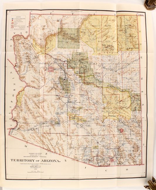
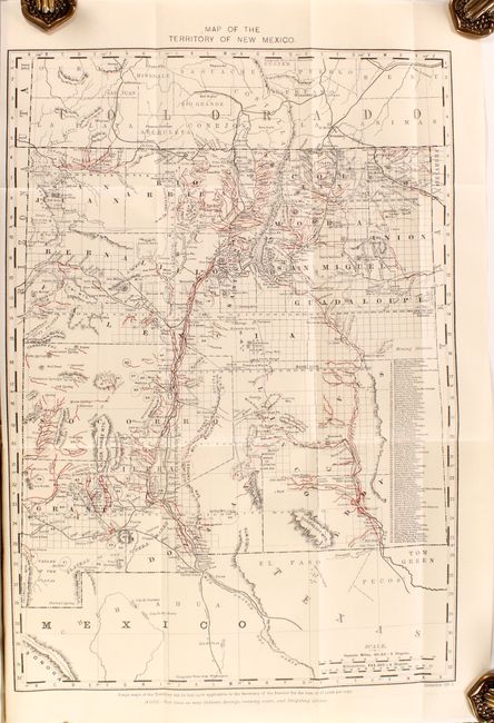
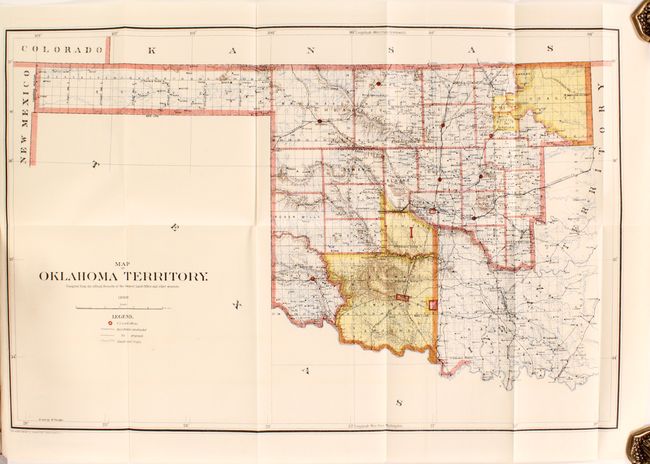
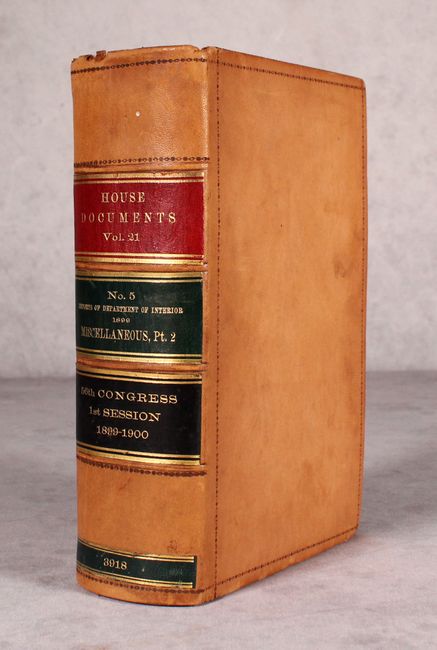
Includes GLO Maps of Arizona, New Mexico and Indian Territory

"Annual Reports of the Department of the Interior for the Fiscal Year Ended June 30, 1899. Miscellaneous Reports. Part II", U.S. Gov't Printing Office

Subject: Southwestern United States

Period: 1899 (published)

Publication: H.R. Doc. 5, 56th Congress, 1st Session

Color: Printed Color

Size:
6 x 9.3 inches
15.2 x 23.6 cm
Download High Resolution Image
(or just click on image to launch the Zoom viewer)

A comprehensive collection of reports bound together comprising the Annual Reports of the Department of the Interior for 1899. They are extensively illustrated with beautiful photography and engraved views. The reports are as follows:

Report of the Governor of Alaska. Contains an untitled folding map intended to establish a provisional boundary line between Canada and the Territory of Alaska and the head of the Lynn Canal in 1899. The map is uncolored and measures 10.5 x 10.3".

Report of the Governor of Arizona. This report includes the popular 1899 General Land Office's Territory of Arizona, a colorful and wonderfully detailed map of the territory. The map includes information of the Indian, Forest and Military Reservations, land grants, large ranches, and much more. This folding map has vivid printed coloring, and measures 16.8 x 20".

Report of the Governor of New Mexico, with a Map of the Territory of New Mexico, showing its running water and irrigation ditches in red over-printing. The map measures 13 x 18.8".

Report of the Governor of Oklahoma. This report includes the General Land Office's 1898 Map of Oklahoma Territory, a good map of the western part of the present state of Oklahoma that also includes a portion of the steadily shrinking Indian Territory. The lands of the Kiowa, Comanche and Apache are depicted in yellow at the bottom; at the top, tribal holdings of the Osage, Ponca, Kansas, Otoe and Missouri are also colored yellow. Army posts are marked in red -- Ft. Sill, Ft. Reno and the Wood Res. Railroads, public roads and trails are identified by symbols shown in the legend. Land Offices are located at Woodward, Alva, Enid, Perry, Guthrie, Kingfisher, Ft. Reno, Oklahoma City, and Mangum. Lawton appears as a Land Office in 1901. This attractive has rich, printed color, and measures 21.8 x 14.3".

Report of the Mine Inspector for the Indian Territory, with many attractive black and white photographs.

Report of the Mine Inspector for the Territory of New Mexico, with several maps of coal mines engraved from the original hand drawn maps.

Hardbound in original calf with gilt title on red, green and black bands on spine. 882 pages. Includes the four original GLO maps of territories, generally not found in the book.

References:

Condition: A

Maps, plates, and text are unusually clean, bright, and fine. Covers have minor wear with a few tiny chips to the head of the spine.

Estimate: $275 - $350

Sold for: $140

Closed on 11/18/2020

Archived