Catalog Archive
Auction 180, Lot 192

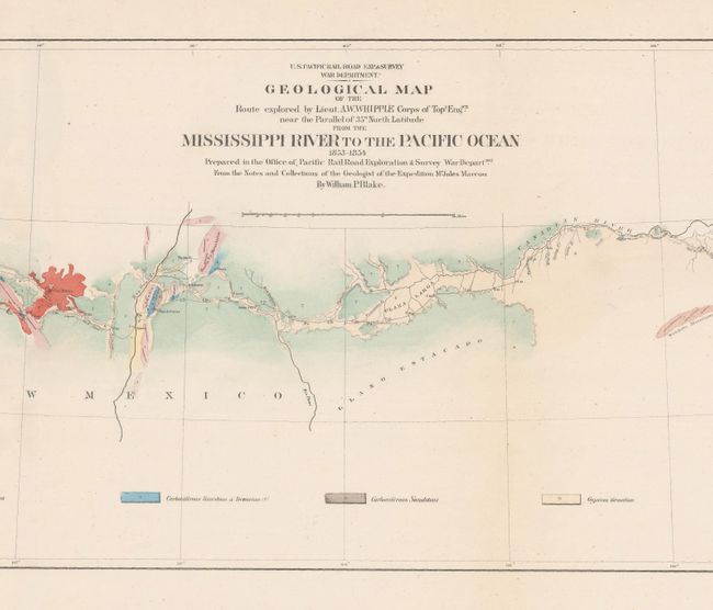
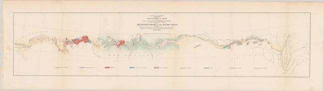
"Geological Map of the Route Explored by Lieut. A.W. Whipple Corps of Topl. Engrs. Near the Parallel of 35 North Latitude from the Mississippi River to the Pacific Ocean 1853-1854...", Whipple, Amiel Weekes

Subject: Western United States

Period: 1854 (dated)

Publication: U.S. Pacific Railroad Surveys

Color: Hand Color

Size:
36.8 x 7.9 inches
93.5 x 20.1 cm
Download High Resolution Image
(or just click on image to launch the Zoom viewer)

During the 1850s, the U.S. government sponsored an extensive series of expeditions designed to gather information on the vast new territories that had been acquired in western North America. The discovery of gold in California further stimulated westward traffic and heightened the need for a faster and more convenient way to bring the far-flung parts of the country together. In 1853 Congress commissioned the Army's Topographic Bureau to conduct a series of surveys to find a suitable route for a transcontinental railroad. There were six major expeditions; five of them covered the area between the Great Plains and west coast, and the sixth explored the coastal states of California and Oregon. All of these expeditions were accompanied by naturalists and artists to document the landscape, flora and fauna along the route. The reports, maps and lithographs were published in the 13 volume report "Explorations and Surveys to ascertain the most practicable and economical route for a Railroad from the Mississippi river to the Pacific Ocean."

This colorful map details the country from Memphis across the West to the small town of Los Angeles. The underlying geology surveyed by the notable geologist Jules Marcou is delineated and color-coded with a legend across the bottom naming nine geological types. The Atchison, Topeka and Santa Fe Railroad later ran along the western part of this survey. A few cities are located along the way; Helena, Napoleon, Vicksburg, Pine Bluff, Little Rock, Fort Smith, San Antonio, Fort Defiance and Needles. The route cuts across the Llano Estacado, north of the Wichita Mountains, and along the edge of the Mogollon Rim, here named the Sierra Mogoyon.

References: Marcou & Marcou #782.

Condition: A

Issued folding with a few faint spots.

Estimate: $140 - $170

Sold for: $100

Closed on 11/18/2020

Archived