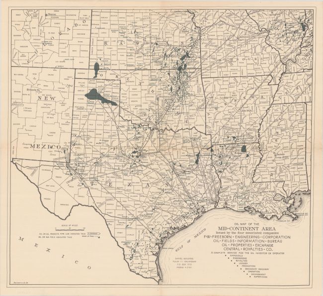
"Oil Map of the Mid-Continent Area...",
Subject: South Central United States, Oil
Period: 1944 (dated)
Publication:
Color: Printed Color
Size:
17.8 x 16.3 inches
45.2 x 41.4 cm
A detailed World War II era oil map of the south central United States issued by FW Freeborn Engineering Corporation of Tulsa, Oklahoma. Centered on Texas, the map extends north to include Kansas, Missouri, and southern Illinois and locates numerous oil and gas fields. A vast network of connecting pipelines are also depicted, including those owned by Shell, Gulf, Humble, and Sinclair to name just a few. Revised to February 14, 1944. There are no past sales records or institutional examples located on OCLC.
References:
Condition: A
Issued folding on a bright sheet with one tiny hole in the right blank margin.