Catalog Archive
Auction 180, Lot 163

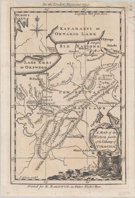
"A Map of the Western Parts of the Colony of Virginia", Gibson, John

Subject: Colonial Mid-Atlantic United States

Period: 1754 (dated)

Publication: London Magazine

Color: Black & White

Size:
4.8 x 7.4 inches
12.2 x 18.8 cm
Download High Resolution Image
(or just click on image to launch the Zoom viewer)

This interesting colonial map illustrates the opening salvo in the French & Indian War. It was engraved to accompany an extract from George Washington's report on his Ohio Valley mission to Virginia's Governor Dinwiddie. The map covers the region from Lakes Erie and Ontario south to the New River and Williamsburg, Virginia. It provides a fine view of the forts, colonial settlements, Indian villages and tribal territory and shows Washington's route from Williamsburg to the French Fort on Lake Erie. A decorative cartouche portrays natives engaged in tobacco production. Published in the June 1754 edition of London Magazine.

Included with the map is a facsimile edition of the 28 page The Journal of Major George Washington... published by the Colonial Williamsburg Foundation.

References: Jolly #LOND-85; Sellers & Van Ee #1426.

Condition: A

Issued folding with a hint of toning.

Estimate: $375 - $450

Sold for: $600

Closed on 11/18/2020

Archived