Catalog Archive
Auction 180, Lot 111

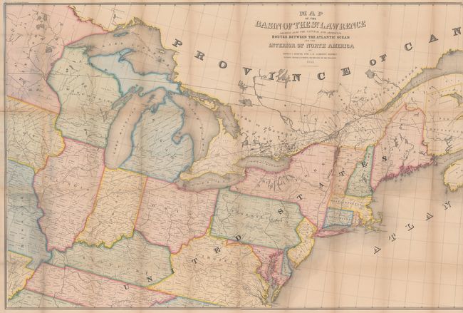
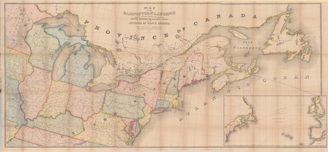
"Map of the Basin of the St. Lawrence Showing Also the Natural and Artificial Routes Between the Atlantic Ocean and Interior of North America", Andrews, Israel D.

Subject: Eastern United States & Canada

Period: 1853 (dated)

Publication: H.R. Doc. 136, 32nd Congress, 1st Session

Color: Hand Color

Size:
76.8 x 34.4 inches
195.1 x 87.4 cm
Download High Resolution Image
(or just click on image to launch the Zoom viewer)

This large and informative map extends from Newfoundland and Nova Scotia west to beyond the 96th parallel, including portions of Minnesota, Iowa, and Missouri. The map emphasizes the rivers and canals in the region that eventually lead to the Atlantic Ocean but does not identify railroads. A large inset at lower right shows the steamer routes connecting North America with Europe. Printed on four sheets and joined. Andrews was a U.S. consul to Canada at the time and was a proponent of stronger economic relations between the two countries, and this map demonstrates their geographic interconnectedness. This is the first example of this map that we have seen in full hand color.

References:

Condition: B

Overall very good for a map of this size with numerous splits at the fold junctions and three larger fold separations measuring 2" (center), 3" (left side) and 6" (right side). There is pleasant light toning and a hint of offsetting. The map is still attached to the rear board at left.

Estimate: $240 - $300

Sold for: $150

Closed on 11/18/2020

Archived