Catalog Archive
Auction 179, Lot 82

"Mappe-Monde sur le Plan d'un Meridien, Hemisphere Occidental", Bonne, Rigobert

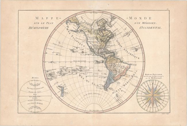
Subject: Western Hemisphere - America

Period: 1788 (circa)

Publication: Atlas Encyclopedique

Color: Hand Color

Size:
13.6 x 9.2 inches
34.5 x 23.4 cm
Download High Resolution Image
(or just click on image to launch the Zoom viewer)

Fine copper engraving shows North and South America with the Atlantic and Pacific Islands and New Zealand. Alaska is approximately the correct shape reflecting Cook's discoveries. At bottom right is a large wind rose called "Rose de Boussole," showing wind directions taken from charts in use in the Mediterranean Sea. A second diagram in the lower left corner balances the composition, with information on the poles and the circles of the earth. Engraved by Andre under the direction of Rigobert Bonne (1727-1795), the Director of the Depot de la Marine and Royal Hydrographer to the King, the map was published with Nicolas Demarest in his "Atlas Encyclopedique" in 1788.

References:

Condition: B+

Watermarked paper with very light toning and a few spots of foxing.

Estimate: $150 - $180

Sold for: $140

Closed on 9/16/2020

Archived