Catalog Archive
Auction 179, Lot 737

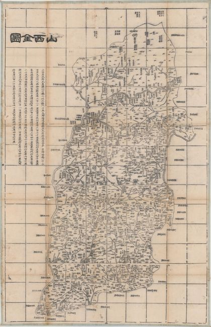
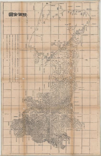
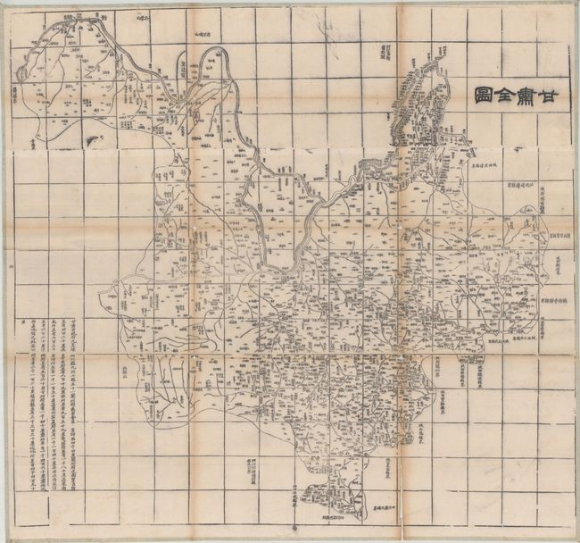
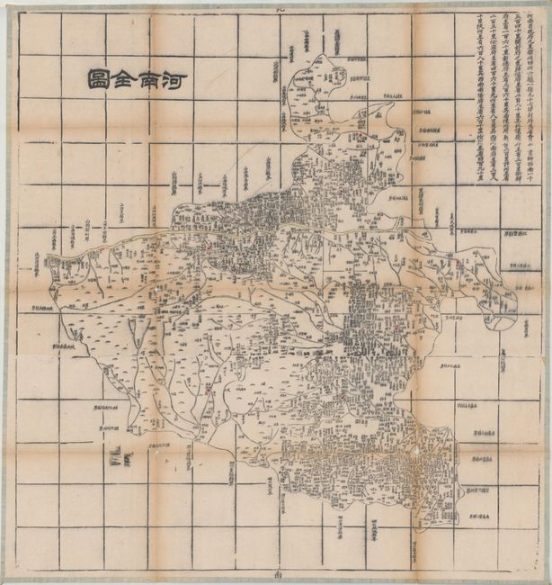
"[Lot of 4 Chinese Maps - Shanxi, Shaanxi, Gansu, and Henan Provinces]",

Subject: Northern China

Period: 1900 (circa)

Publication:

Color: Black & White

Size:
See Description
Download High Resolution Image
(or just click on image to launch the Zoom viewer)

This set of Chinese maps show 4 provinces in northern China. Each map is filled with detail, including towns, rivers, topography, and depictions of the Great Wall in three of the four maps.

A. [Shanxi Province], (21.8 x 33.6"). The Yellow River forms the western border.

B. [Shaanxi Province], (25.8 x 40.7"). With Xian near the center and the Yellow River on the eastern border.

C. [Gansu Province], (32.1 x 35.0"). Shows the northern portion of Gansu and Ningxia provinces.

D. [Henan Province], (26.1 x 27.6"). The Yellow River extends through the northern portion of the province.

References:

Condition: B

The maps are issued folding and backed in a very thin linen with small string loopholes at each corner for hanging. There is toning along the folds, light soiling, tiny worm holes, and a number of fold separations with some small areas of loss at fold intersections.

Estimate: $350 - $425

Sold for: $250

Closed on 9/16/2020

Archived