Catalog Archive
Auction 179, Lot 461

Ortelius' Earliest Map of Britain

"Angliae, Scotiae, et Hiberniae, sive Britannicar: Insularum Descriptio", Ortelius, Abraham
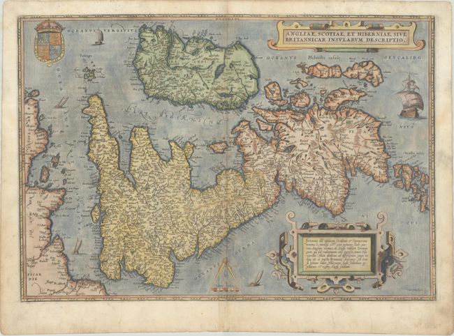
Subject: Britain

Period: 1574 (published)

Publication: Theatrum Orbis Terrarum

Color: Hand Color

Size:
19.3 x 13.4 inches
49 x 34 cm
Download High Resolution Image
(or just click on image to launch the Zoom viewer)

This map, based on the cartography of Gerard Mercator, is Ortelius' earliest map of Britain. Flemish influence, or possibly a mistranslation, is evident in the rendering of some of the place names, e.g. Ormyskyrk for Ormskirk, Dantre for Daventry, and the omission of the relatively important Peterborough. Distinguished by a sophisticated style of engraving, the map is embellished with two ornate strapwork cartouches, the royal coat of arms of the UK, dividers and distance scale and five sailing ships. French text on verso.

References: Shirley (MCC-94) #86, pl. 42; Van den Broecke #16.

Condition: B+

A nice impression with gilt highlights on paper with a bunch of grapes watermark and some small spots along the centerfold.

Estimate: $700 - $850

Sold for: $550

Closed on 9/16/2020

Archived