Catalog Archive
Auction 179, Lot 450

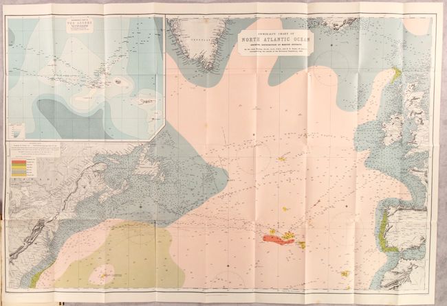
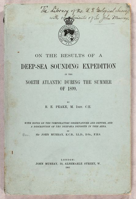
Presentation Example from Sir John Murray - The Father of Modern Oceanography

"Admiralty Chart of North Atlantic Ocean Showing Distribution of Marine Deposits [in] On the Results of a Deep-Sea Sounding Expedition in the North Atlantic During the Summer of 1899", Royal Geographical Society

Subject: North Atlantic

Period: 1901 (published)

Publication:

Color: Printed Color

Size:
43.5 x 28.4 inches
110.5 x 72.1 cm
Download High Resolution Image
(or just click on image to launch the Zoom viewer)

This large and striking chart covers the north Atlantic Ocean from Great Britain and Spain to eastern North America. It was a result of survey work completed in advance of two companies laying telegraphic lines across the Atlantic: the Deutsch-Atlantische Telegraphengesellschaft (German) and the Commercial Cable Company (American). The chart is filled with relevant details including hundreds of soundings, ocean currents, notations, magnetic variation, and is augmented by vibrant color to depict seven different types of marine deposits. Features a large inset of the Azores at top left (both companies routed their lines through the Azores). Accompanied by 44 pages of text by John Murray and R.E. Peake. Octavo, hardbound in stiff blue paper boards (6.3 x 9.5"). This example was presented to the U.S. Geological Survey and signed on the front cover by Sir John Murray.

References:

Condition: A

The folding map is clean and colorful with just a few spots of foxing and a very short binding tear at left. Text has an occasional spot of foxing and an old library stamp on the title page and front pastedown.

Estimate: $220 - $250

Sold for: $160

Closed on 9/16/2020

Archived