Catalog Archive
Auction 179, Lot 370

"Pas-kaart van de Golff de Guanaios met 't Canaal Tusschen Yucatan en I. Cuba", Keulen, Johannes van

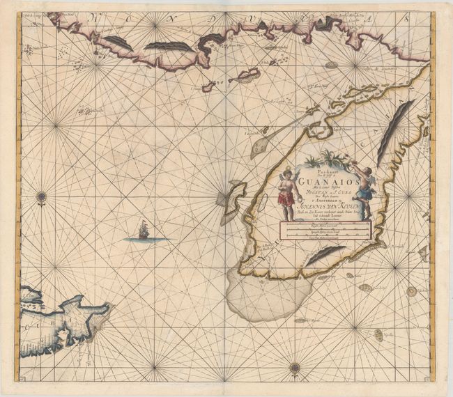
Subject: Gulf of Mexico & Cuba

Period: 1695 (circa)

Publication: Zee-Fakkel

Color: Hand Color

Size:
22.8 x 20.1 inches
57.9 x 51.1 cm
Download High Resolution Image
(or just click on image to launch the Zoom viewer)

This superb sea chart covers the Yucatan Peninsula, the eastern coast of Honduras, and the western part of Cuba. The map is filled with impressive detail of the shoals and anchorages and is embellished with rhumb lines, compass roses, and a sailing ship. North is oriented to the bottom of the sheet. Putti flank the title cartouche.

References:

Condition: B+

Nice impression and color with light soiling and some creasing and cockling of the paper at top. There is one tiny hole that has been archivally infilled. The grayish shadow along the centerfold is caused by our scanner and doesn't appear on the map itself.

Estimate: $550 - $650

Sold for: $500

Closed on 9/16/2020

Archived